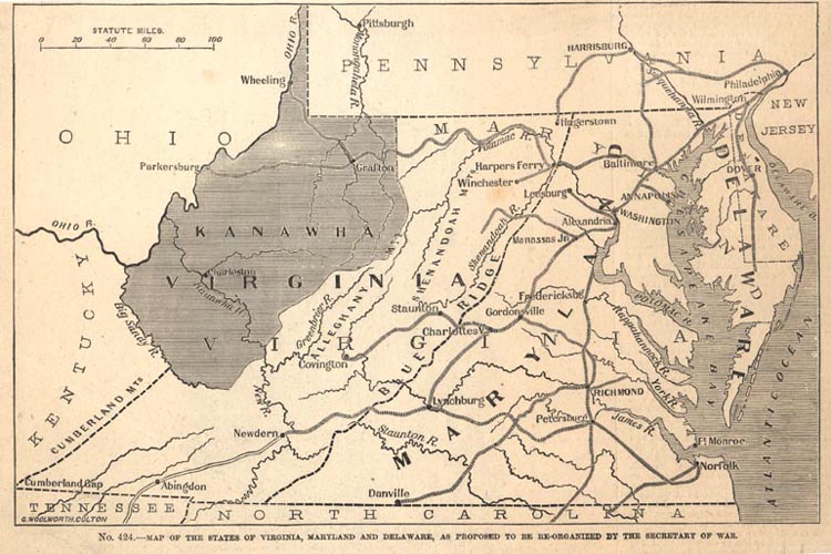

Proposed state of kanawha
1862 Map Showing the Proposed State of Kanawha, from Frank Leslie's Pictorial History of the American Civil War, 1862 (Ma61- 25)
- Date
- 1862
- Mapmaker / publisher
- Frank Leslie
- Place
- proposed US States
- Archive
- Wikimedia Commons
- Type
- map
- Original size
- 750 × 500 pixels
Public domain
Reason: a US government work.
This status rests on the map's publication history, as researched by Wikimedia Commons. Check it before commercial use.
Read from: Commons licence category: PD US; no CC BY, CC BY-SA, GFDL or deletion tag on the file page.
Credit line
"Proposed state of kanawha" (1862). Frank Leslie, via Wikimedia Commons. Public domain. https://commons.wikimedia.org/wiki/File:Proposed_state_of_kanawha.jpgNeed maps for a whole project? Add Find Any Map to Claude and ask for this one by its id: 618.
More like this

Map of western Virginia
1862 · Library of Congress

Map of western Virginia
1862 · Library of Congress

Title map of the coal field of the great Kanawha Valley.
1867 · Library of Congress

Map of the James River Etc. from Richmond to the Ocean (Harper's Weekly, January 1862)
1862 · Wikimedia Commons

Map of the "Kanawha City" estates, Kanawha County, West Virginia, United States of America
1875 · Library of Congress

Map of the state of Virginia - containing the counties, principal towns, railroads, rivers, canals & all other internal improvements.
1864 · Library of Congress

1852 Map of the Virginia Central Railroad and Planned Construction
1852 · Library of Congress

Map of the proposed line of Rail Road connection between tide water Virginia and the Ohio River at Guyandotte, Parkersburg and Wheeling
1852 · Library of Congress