

Powles pp.128–9 sit.7.11.17
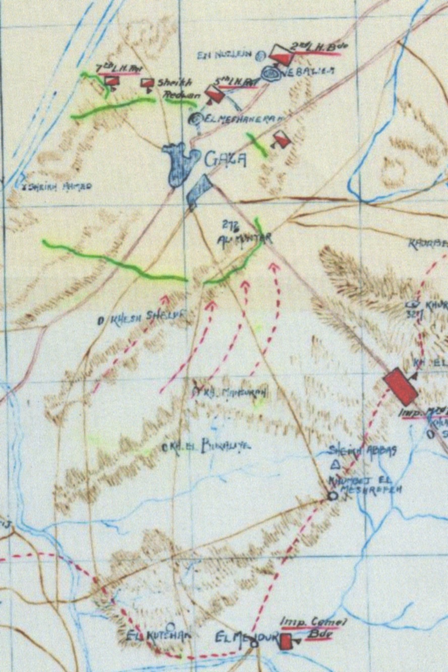
Map of situation as known to the General Headquarters of the EEF on 7 November 1917;Other information: Government publication - official history
- Date
- 1922
- Mapmaker / publisher
- C. Guy Powles
- Archive
- Wikimedia Commons
- Type
- map
- Original size
- 2,234 × 2,795 pixels
Public domainsafest
Reason: its US copyright has expired (published before 1931).
Read from: Commons licence category: PD US expired; no CC BY, CC BY-SA, GFDL or deletion tag on the file page.
Credit line
"Powles pp.128–9 sit.7.11.17" (1922). C. Guy Powles, via Wikimedia Commons. Public domain. https://commons.wikimedia.org/wiki/File:Powles_pp.128%E2%80%939_sit.7.11.17.jpgNeed maps for a whole project? Add Find Any Map to Claude and ask for this one by its id: 11465.
More like this

Powles pp.112-3sit.29.10.17
1922 · Wikimedia Commons

Powles pp.160-1 16.11.17
c. 1922 · Wikimedia Commons

Map of Beersheba position at dusk on 31 October 1917
1941 · Wikimedia Commons

Battle of Rafa map (Powles pp.80-1)
1922 · Wikimedia Commons
Sketch Map of the 1st Battle of Gaza at 14:00;Other information: Australian Government publication
1917 · Wikimedia Commons

Detail of sketch map showing positions at 14:00 during First Battle of Gaza;Other information: Australian Government document
1917 · Wikimedia Commons

Powles pp.176-7Jericho map
1922 · Wikimedia Commons

Sketch Map of Ottoman positions on 19 July 1917;Other information: Army War Diary - government documents
1917 · Wikimedia Commons