
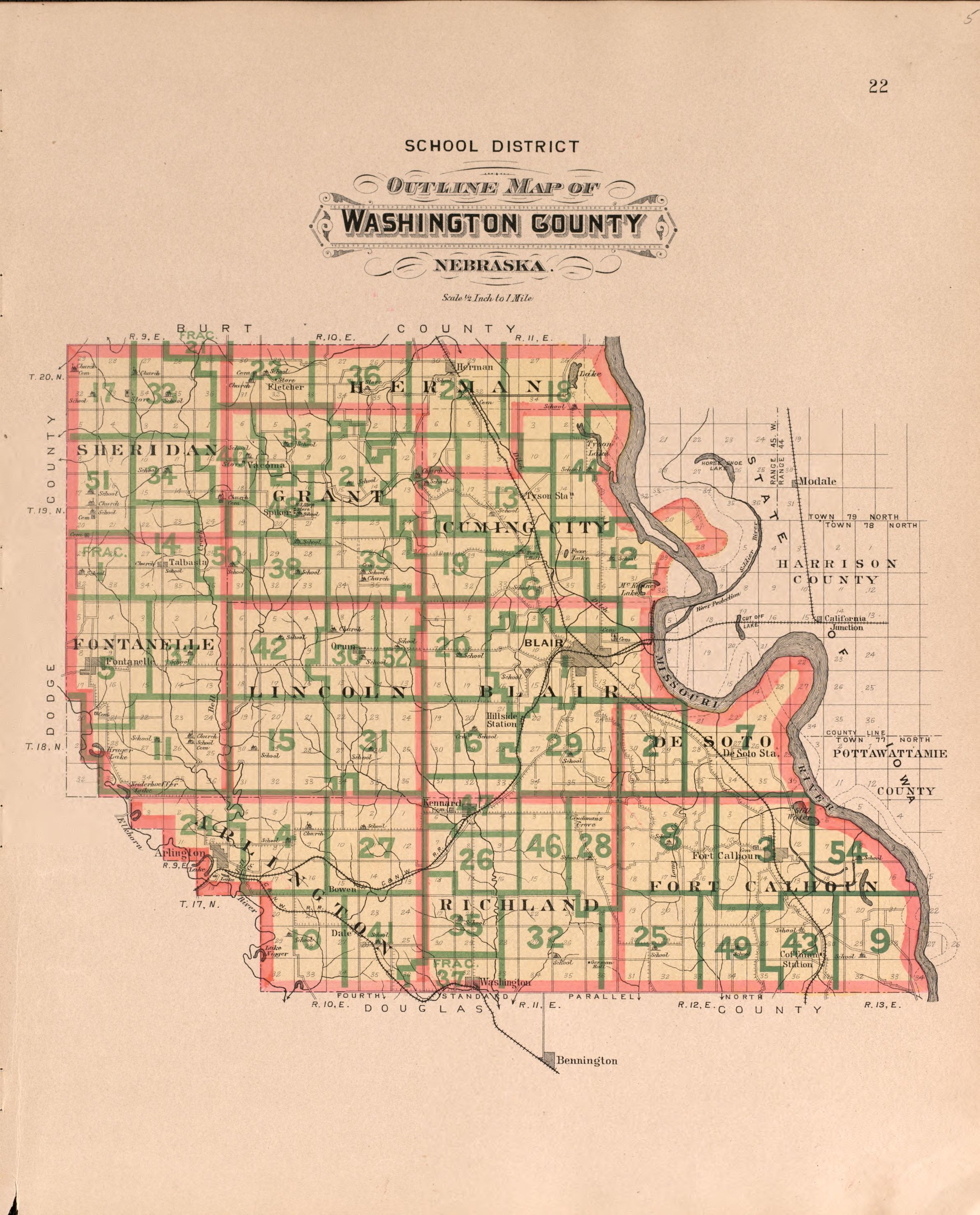
Plat book of Washington County, Nebraska - containing carefully prepared township plats, village plats, analysis of U.S. land system, state, United States and world maps - illustrated
Includes indexes, brief history of Washington County, and portraits of early Saunders County residents and residences. p. separated from binding. Vendor: John Carbonell (eBay auction) Acquisitions control no. 2007-013
- Date
- 1908
- Mapmaker / publisher
- C.H. Scoville Co.; Volk, Albert
- Archive
- Library of Congress (via Wikimedia Commons)
- Type
- map
- Sheets
- 37
- Original size
- 2,217 × 2,889 pixels
Public domainsafest
Reason: its maker died more than 100 years ago.
Read from: Commons licence category: PD-old-100-expired; no CC BY, CC BY-SA, GFDL or deletion tag on the file page.
Credit line
"Plat book of Washington County, Nebraska - containing carefully prepared township plats, village plats, analysis of U.S. land system, state, United States and world maps - illustrated" (1908). C.H. Scoville Co.; Volk, Albert. Library of Congress, Geography and Map Division, via Wikimedia Commons. Public domain. https://commons.wikimedia.org/wiki/File:Plat_book_of_Washington_County,_Nebraska_-_containing_carefully_prepared_township_plats,_village_plats,_analysis_of_U.S._land_system,_state,_United_States_and_world_maps_-_illustrated_LOC_2007626722-1.jpgNeed maps for a whole project? Add Find Any Map to Claude and ask for this one by its id: 136455.
All 37 sheets
Each sheet links to its file at the archive; the image link is the full-size scan.




More like this

Plat book of Saunders County, Nebraska - containing carefully prepared township plats, village plats, analysis of U.S. land system, leading farmers directory - illustrated.
1907 · 40 sheets

Standard atlas of Cuming County, Nebraska - including a plat book of the villages, cities and townships of the county, map of the state, United States and world, patrons directory, reference business
1908 · 40 sheets

Standard atlas of Seward County, Nebraska - including a plat book of the villages, cities and townships of the county, map of the state, United States and world, patrons directory, reference
1908 · 38 sheets

Plat book of Lancaster County, Nebraska - containing carefully prepared township plats, village plats, analysis of U.S. land system, leading farmers directory, reminiscences of old settlers
1903 · 40 sheets

Plat book of Washington County, Minnesota - showing township plats, city and village plats, sub-division plats, and county map - compiled from official records
1938 · 38 sheets

Atlas of Saunders County, Nebraska - containing maps of townships of the county, maps of state, United States and world, farmers directory, analysis of the system of U.S. land surveys.
1916 · 40 sheets

Standard atlas of Custer County, Nebraska - including a plat book of the villages, cities and townships of the county, map of the state, United States and world, patrons directory, reference
1904 · 39 sheets

Plat book of Washington and Ozaukee counties, Wisconsin - compiled from county records and actual surveys
1915 · 40 sheets