

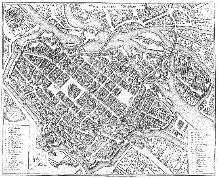
Plan wrocławia1
- Mapmaker / publisher
- Barthel&Georg Weihner (1562), copy of J. Partsch (1826)
- Archive
- Wikimedia Commons
- Type
- map
- Original size
- 690 × 808 pixels
Public domain
Reason: its maker died more than 70 years ago, and a faithful scan of a flat work adds no new copyright.
This status rests on the map's publication history, as researched by Wikimedia Commons. Check it before commercial use.
Read from: Commons licence category: PD-Art (PD-old-70); no CC BY, CC BY-SA, GFDL or deletion tag on the file page.
Credit line
"Plan wrocławia1". Barthel&Georg Weihner (1562), copy of J. Partsch (1826), via Wikimedia Commons. Public domain. https://commons.wikimedia.org/wiki/File:Plan_wroc%C5%82awia1.jpgNeed maps for a whole project? Add Find Any Map to Claude and ask for this one by its id: 137798.
More like this

Fragment map
February 1, 1562 · Wikimedia Commons

Wrocławskie Nowe Miasto
1562–1826 · 2 sheets

Mury miejskie we Wrocławiu 1562
1562–1826 · Wikimedia Commons

Rynek we Wrocławiu 1562
1562–1826 · Wikimedia Commons

K. salvatore XVI
1562–1826 · Wikimedia Commons
Wratislavia - Breßlaw
c. 1660 · Wikimedia Commons

Ostrów Tumski we Wrocławiu
1562–1826 · Wikimedia Commons

Wratislavia - Bresslaw. 1641 (corrected)
1641 · Wikimedia Commons