

Plan Rome - Tabularium
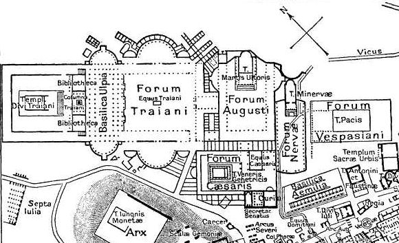
Tabularium on a map of ancient downtown Rome
- Date
- December 30, 2007
- Place
- Rome from Nordisk familjebok
- Archive
- Wikimedia Commons
- Type
- map
- Original size
- 1,099 × 777 pixels
Public domain
Reason: public domain: anon-70-EU.
This status rests on the map's publication history, as researched by Wikimedia Commons. Check it before commercial use.
Read from: Commons licence category: PD-anon-70-EU; no CC BY, CC BY-SA, GFDL or deletion tag on the file page.
Credit line
"Plan Rome - Tabularium" (December 30, 2007). Wikimedia Commons. Public domain. https://commons.wikimedia.org/wiki/File:Plan_Rome_-_Tabularium.pngNeed maps for a whole project? Add Find Any Map to Claude and ask for this one by its id: 20172.
More like this

Partial Map of downtown Rome during the Roman Empire large with scalae Gemoniae marked
May 10, 2007 · Wikimedia Commons
Foramap
Wikimedia Commons

Map of downtown Rome during the Roman Empire large
1916 · Wikimedia Commons

Forum Romanum Arcus Augusti
Wikimedia Commons

Map of downtown Rome during the Roman Empire large - Temple of Casear
Wikimedia Commons

Forum map - Regia
1916 · Wikimedia Commons

Roma Plan bw
1886 · Wikimedia Commons

Map of downtown Rome during the Roman Empire large - Arch of Augustus
Wikimedia Commons