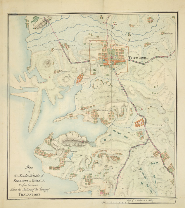

Plan of the Hindu temple at Trichur
MacMPen-and-ink and water-colour drawing of the plan of the Hindu temple at Trichur, by John Gould, dated 11 June 1816. Inscribed on front in ink: 'Plan of the Hindoo Temple of Trichoore in Kerala & of its Environs. From the Section of the Survey of Travancore. J. Gould 11th June, 1816.' Travancore, one of the three princely states of Kerala, consists of three natural divisions, a coastal area dotted with lagoons to the west, a midland in the centre and mountain peaks as high as 9,000 feet on the east. One of the most important Hindu complex of Kerala is the Vadakkunatha Temple at Trichur, founded in the 12th century and later reconstructed in the 19th century. The temple houses three shrines (srikovils) facing west, aligned in a single row in a rectangular court surrounded by a colonnnade. The northern one is a circular temple known as Vadakkunnatha, dedicated to Shiva. That at the south is dedicated to Rama. The central of the three temples is dedicated to Shankara Narayana (Hari-Hara), the combined form of Shiva and Vishnu and has a double-roofed circular srikovil. The conical timber roofs are covered with metal and crowned with pot finials. To the west of each shrine is an open
- Date
- 1951
- Place
- Thrissur
- Archive
- Wikimedia Commons
- Type
- map
- Original size
- 633 × 712 pixels
Public domainsafest
Reason: its US copyright has expired (published before 1931).
Read from: Commons licence category: PD US expired; no CC BY, CC BY-SA, GFDL or deletion tag on the file page.
Credit line
"Plan of the Hindu temple at Trichur" (1951). Wikimedia Commons. Public domain. https://commons.wikimedia.org/wiki/File:Plan_of_the_Hindu_temple_at_Trichur.jpgNeed maps for a whole project? Add Find Any Map to Claude and ask for this one by its id: 256882.
More like this

Plans for alterations to the fortifications at Cochin
1780–1800 · Wikimedia Commons

Floor plan of the Cochin fort
1782 · Wikimedia Commons

A plan published by the Van Keulen family in 'De Zee En Land-Caarten en Gizigeten van steeden en landvertooningen van oost-indien', 1752
1752 · Wikimedia Commons

Map of areas belonging to the ruler of Trevancore
1700–1800 · Wikimedia Commons

Sketch plan of the attack on Mysore
1791 · Wikimedia Commons

Map of Trichinapoly and environs
1757 · Wikimedia Commons

The earliest map of Ram Janmasthan at Ayodhya (1717 CE)
1717 · Wikimedia Commons

Maps of the forts at Cananor, Cranganor, Coylan and Calicoilan
1690–1705 · AMH-2583-NA Maps of the forts at Cananor