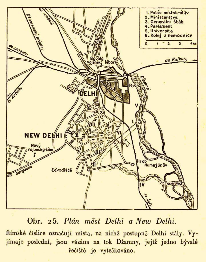

Plán měst Delhi a New Delhi
Map of Delhi and New Delhi after the First World War. The descriptions are in Czech.
- Date
- 1931
- Place
- India
- Archive
- Wikimedia Commons
- Type
- map
- Original size
- 721 × 916 pixels
Public domain
Reason: its maker died more than 70 years ago, and a faithful scan of a flat work adds no new copyright.
This status rests on the map's publication history, as researched by Wikimedia Commons. Check it before commercial use.
Read from: Commons licence category: PD-Art (PD-old-70); no CC BY, CC BY-SA, GFDL or deletion tag on the file page.
Credit line
"Plán měst Delhi a New Delhi" (1931). Wikimedia Commons. Public domain. https://commons.wikimedia.org/wiki/File:Pl%C3%A1n_m%C4%9Bst_Delhi_a_New_Delhi.jpgNeed maps for a whole project? Add Find Any Map to Claude and ask for this one by its id: 255776.
More like this

Plan map of the City of Delhi, published in the 'Imperial Gazetteer of India' (Vol. XXVI, Atlas; 1931 revised edition; plate no. 57)
1931 · Wikimedia Commons

Map of the City of Delhi, Punjab Province, British India, published in 'The Panjab, North-West Frontier Province and Kashmir'
1916 · Wikimedia Commons

Okolí Bombaje
1931 · Wikimedia Commons

Politická mapa Indie
1931 · Wikimedia Commons

Delhi and environs (Baedeker, 1914)
1914 · Wikimedia Commons

Delhi and its immediate environs, 1909, from Murray's Handbook for Travelers
1909 · Wikimedia Commons

Map of Lutyens' projected Imperial Delhi, from the Encyclopedia Britannica, 11th ed., 1910-12
1910 · Wikimedia Commons

Map of Delhi Enclave of Punjab Province, British India, published in 'The Panjab, North-West Frontier Province and Kashmir'
1916 · Wikimedia Commons