

Plan du faux paris 1917
- Date
- August 5, 1917
- Place
- Paris
- Archive
- Wikimedia Commons
- Type
- map
- Original size
- 416 × 485 pixels
Public domainsafest
Reason: its US copyright has expired (published before 1931).
Read from: Commons licence category: PD US expired; no CC BY, CC BY-SA, GFDL or deletion tag on the file page.
Credit line
"Plan du faux paris 1917" (August 5, 1917). Wikimedia Commons. Public domain. https://commons.wikimedia.org/wiki/File:Plan_du_faux_paris_1917.jpgNeed maps for a whole project? Add Find Any Map to Claude and ask for this one by its id: 298962.
More like this

Map of fake Paris 1917
September 1, 1917 · Wikimedia Commons
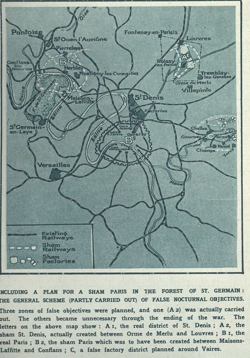
Map of fake Paris and suburban 1917
September 1, 1917 · Wikimedia Commons

Marche des trains pc 1918 jms
1918 · Wikimedia Commons

A. Taride, Plan des lignes de tramways et d'autobus de Paris, 1915 - Gallica
1915 · Wikimedia Commons

Taride, Nouveau Plan du chemin de fer métropolitain de Paris 1905 - Gallica
1905 · Wikimedia Commons

A. Taride, Paris Nouveau plan de Paris avec toutes les lignes du Métropolitain et du Nord-Sud, 1915 - Gallica
1915 · Wikimedia Commons

Plan de Paris et du Chemin de fer Métropolitain distinguant les Lignes en exploitation, Autres lignes du réseau concédé, Ligne éventuelle
1900 · Wikimedia Commons

Compagnie du chemin de fer métropolitain. Paris. Lignes en exploitation
1908 · Wikimedia Commons