

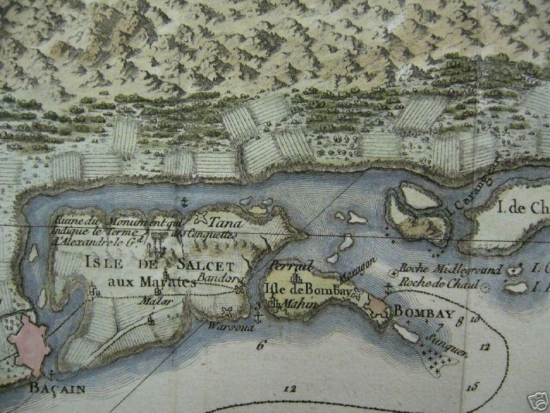
Plan de Bombay et ses Environs.
1764 Bellin Map of Bombay (Mumbai) India
An extremely attractive and rare 1764 map of Bombay or Mumbai, India by J. N. Bellin. Depicted the peninsula of Bombay as it was in the 1700s – divided into several small islands including Salcet, Bombay, and the Isle of the Jesuits. Shows the city and fort of Bombay at the southern tip of Bombay Island. Also shows the villages of Salcet, Cayman, Mayen, Colay, Bandura and Trombay. Includes the coast of mainland India from the Negalan River northward past the River Penn to what is today Panvel Creek. Offers considerable offshore detail including depth soundings around Bombay Harbor and references to shoals and anchorage. Decorative title cartouche in the baroque style in the lower left quadrant. Prepared by J. N. Bellin for issued as Map no. 25 in vole III of the 1864 issue of Le Petit Atlas Maritime.
- Date
- 1764
- Place
- Mumbai
- Archive
- Wikimedia Commons
- Type
- map
- Original size
- 2,099 × 2,705 pixels
Public domainsafest
Reason: its maker died more than 100 years ago, and a faithful scan of a flat work adds no new copyright.
Read from: Commons licence category: PD-Art (PD-old-100); no CC BY, CC BY-SA, GFDL or deletion tag on the file page.
Credit line
"Plan de Bombay et ses Environs." (1764). Wikimedia Commons. Public domain. https://commons.wikimedia.org/wiki/File:1764_Bellin_Map_of_Bombay_(Mumbai)_India_-_Geographicus_-_Bombay-bellin-1750.jpgNeed maps for a whole project? Add Find Any Map to Claude and ask for this one by its id: 255574.
More like this

A Surat-to-Bombay map by Benard, from Pierre de Pagès' 'Voyages Autour Du Monde', Paris, 1782 an overview of the Bombay region
1782 · Wikimedia Commons
A Surat-to-Bombay map by Benard, from Pierre de Pagès' 'Voyages Autour Du Monde', Paris, 1782 *the Bombay region
1782 · Wikimedia Commons

Plan de la Forteresse de Coylan.
1756 · 1756 Bellin Map of Kollam Fort

A Surat-to-Bombay map by Benard, from Pierre de Pagès' 'Voyages Autour Du Monde', Paris, 1782 whole map
1782 · Wikimedia Commons

Bellin's "Map of the port of Goa and its surroundings," 1764; with modern hand coloring
1764 · Wikimedia Commons

Carte Plate qui Comprend L'Isle de Ceylan, et une partie des Cotes de Malabar et de Cormandel.
1775 · Wikimedia Commons

A Surat-to-Bombay map by Benard, from Pierre de Pagès' 'Voyages Autour Du Monde', Paris, 1782 *the Surat to Daman region
1782 · Wikimedia Commons

Bombay, etablissement des Anglois à la côte Malabar
1760 · Wikimedia Commons