

Placer County California
Accompanied by text: Register of mines and minerals, data collected February, 1902, 23 x 30 cm., 22 p.
- Date
- 1902
- Mapmaker / publisher
- California State Mining Bureau
- Place
- California
- Archive
- Library of Congress (via Wikimedia Commons)
- Type
- map
- Original size
- 9,304 × 5,974 pixels
Public domainsafest
Reason: its maker died more than 100 years ago.
Read from: Commons licence category: PD-old-100-expired; no CC BY, CC BY-SA, GFDL or deletion tag on the file page.
Credit line
"Placer County California" (1902). California State Mining Bureau. Library of Congress, Geography and Map Division, via Wikimedia Commons. Public domain. https://commons.wikimedia.org/wiki/File:Placer_County_California_LOC_2007633931.jpgNeed maps for a whole project? Add Find Any Map to Claude and ask for this one by its id: 135337.
More like this

Placer County California State Mining Bureau 1902 master-gmd-gmd436-g4363-g4363p-ct001904
December 31, 1902 · Library of Congress

Map of El Dorado County, California
1909 · Library of Congress

County of Nevada, California
1909 · Library of Congress

Keddie's map of Plumas County, California
1892 · Plate 1

Map of the County of El Dorado, California - compiled from the official records and surveys
1895 · Library of Congress

Map of Nevada County, California
1880 · Library of Congress
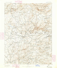
Placerville, California: USGS topographic map, 1:125,000 (1891–1893)
1891–1893 · 11 editions

Official map of Yuba County, State of California - compiled and drawn from official recs. and actual surveys
1887 · Library of Congress