

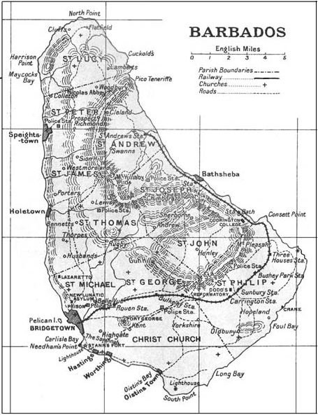
Pg585
- Date
- 1848
- Place
- Barbados
- Archive
- Wikimedia Commons
- Type
- map
- Original size
- 1,392 × 497 pixels
Public domainsafest
Reason: its maker died more than 70 years ago.
Read from: Commons licence category: PD-old-70-expired; no CC BY, CC BY-SA, GFDL or deletion tag on the file page.
Credit line
"Pg585" (1848). Wikimedia Commons. Public domain. https://commons.wikimedia.org/wiki/File:Pg585.jpgNeed maps for a whole project? Add Find Any Map to Claude and ask for this one by its id: 295013.
More like this

Pg580 Fig2 Section from South Point through the Rising Sun and the Valley
1848 · Wikimedia Commons

Pg580 Fig1 Section fromnear Paynes Bay to Chalky Mount
1848 · Wikimedia Commons

Pg300 Map of the Caribbee Islands to the year 1536
1848 · Wikimedia Commons

Pg581 Fig3 Map of the Central Ridge
1848 · Wikimedia Commons

Map of Barbados Thomas Jefferys 1750
1750 · Wikimedia Commons

A New map of the island of Barbadoes / by Phillip Lea
1690–1695 · Wikimedia Commons
Algernon Aspinall 'The Pocket Guide to the West Indies'. 515 pages. New York, 1923
1923 · Wikimedia Commons

Map of Tobago
1888 · Wikimedia Commons