

PearlHarborCarrierChart
- Place
- the Pearl Harbor attack
- Archive
- Wikimedia Commons
- Type
- map
- Original size
- 1,004 × 710 pixels
Public domainsafest
Reason: a US government work.
Read from: Commons licence category: PD US Government; no CC BY, CC BY-SA, GFDL or deletion tag on the file page.
Credit line
"PearlHarborCarrierChart". Wikimedia Commons. Public domain. https://commons.wikimedia.org/wiki/File:PearlHarborCarrierChart.jpgNeed maps for a whole project? Add Find Any Map to Claude and ask for this one by its id: 24635.
More like this
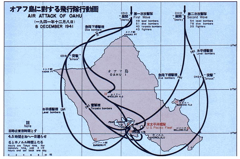
Pearl Harbor bombings map
Wikimedia Commons
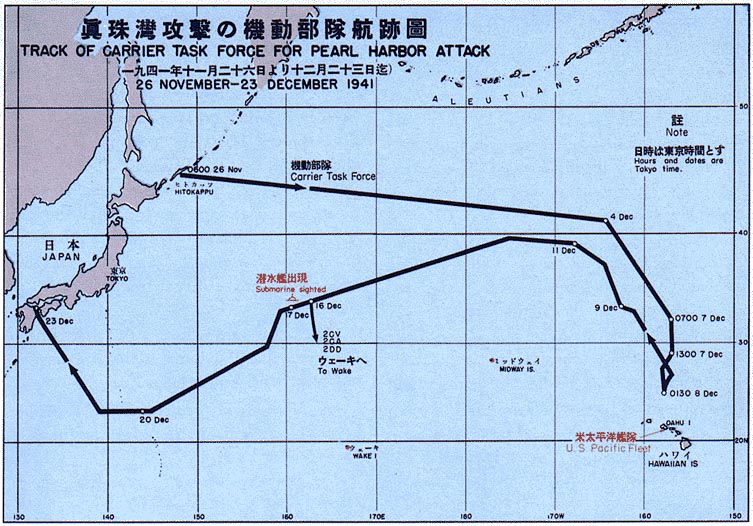
Map of Pearl Harbor attack force
1966 · Wikimedia Commons

Map showing ships present at Pearl Harbor on 7 December 1941 cropped
1975 · Wikimedia Commons

Map showing ships present at Pearl Harbor on 7 December 1941
1975 · Wikimedia Commons

Map of Pearl Harbor, Hawaii, with approximate position of ships on 7 December 1941 (80-G-47105)
December 7, 1941 · U.S. National Archives

Half-tone image of a photograph, Map of Pearl Harbor made during the first six months of the Pacific war, released in connection with publication of “Battle Report” by Commander Walter Karig, USNR, an
1944 · Wikimedia Commons

Battle of Peleliu map
Wikimedia Commons

Half-tone image of a photograph, Map of Pearl Harbor made during the first six months of the Pacific war, released in connection with publication of “Battle Report” by Commander Walter Karig, USNR, an
Wikimedia Commons