

Pearl Harbor chart found in Japanese midget sub
- Date
- 1941
- Mapmaker / publisher
- Imperial Japanese Navy
- Place
- the Pearl Harbor attack
- Archive
- Wikimedia Commons
- Type
- chart
- Original size
- 595 × 675 pixels
Public domainsafest
Reason: a US government work (US Navy).
Read from: Commons licence category: PD US Navy; no CC BY, CC BY-SA, GFDL or deletion tag on the file page.
Credit line
"Pearl Harbor chart found in Japanese midget sub" (1941). Imperial Japanese Navy, via Wikimedia Commons. Public domain. https://commons.wikimedia.org/wiki/File:Pearl_Harbor_chart_found_in_Japanese_midget_sub.jpgNeed maps for a whole project? Add Find Any Map to Claude and ask for this one by its id: 24638.
More like this

Japanese map of Pearl Harbor 1941
1941 · Wikimedia Commons

Half-tone image of a photograph, Map of Pearl Harbor made during the first six months of the Pacific war, released in connection with publication of “Battle Report” by Commander Walter Karig, USNR, an
1944 · Wikimedia Commons

Map of Pearl Harbor, Hawaii, with approximate position of ships on 7 December 1941 (80-G-47105)
December 7, 1941 · U.S. National Archives

Half-tone image of a photograph, Map of Pearl Harbor made during the first six months of the Pacific war, released in connection with publication of “Battle Report” by Commander Walter Karig, USNR, an
Wikimedia Commons
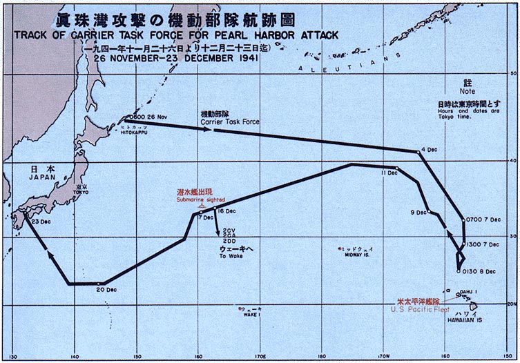
Map of Pearl Harbor attack force
1966 · Wikimedia Commons

Map showing ships present at Pearl Harbor on 7 December 1941 cropped
1975 · Wikimedia Commons
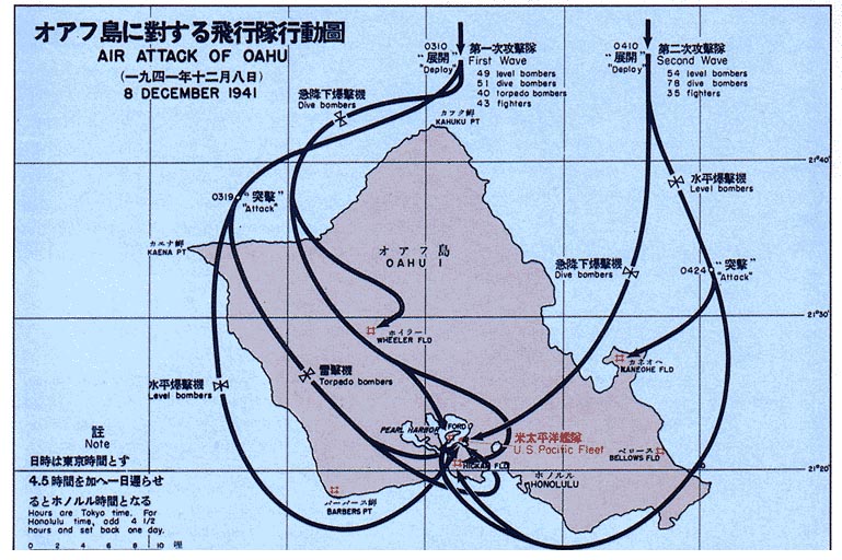
Pearl Harbor bombings map
Wikimedia Commons

Japanese attack plan at Pearl Harbor, Japan, 1941
1941 · Wikimedia Commons