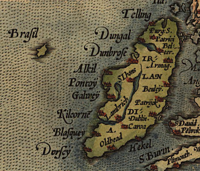

Ortelius 1572 Ireland Map 2
Detail of Abraham Ortelius' 1572 map of Europe, depicting Ireland. The phantom island of Brasil is shown to the west.
- Date
- 1571
- Place
- Ireland
- Archive
- Wikimedia Commons
- Type
- map
- Original size
- 693 × 594 pixels
Public domainsafest
Reason: its maker died more than 100 years ago.
Read from: Commons licence category: PD-old-100-expired; no CC BY, CC BY-SA, GFDL or deletion tag on the file page.
Credit line
"Ortelius 1572 Ireland Map 2" (1571). Wikimedia Commons. Public domain. https://commons.wikimedia.org/wiki/File:Ortelius_1572_Ireland_Map_2.jpgNeed maps for a whole project? Add Find Any Map to Claude and ask for this one by its id: 243696.
More like this

Hiberniae, Britannicae Insulae, Nova Descriptio. Eryn. Irlandt
Abraham Ortelius

Hiberniae Britannicae Insulae, Nova Descriptio, Eryn, Irlandt
1573 · Wikimedia Commons

Atlas type Lafréri
1543–1577 · Ireland, plate 23 of 226

Argentine Ptolemy Ireland 1513
1513 · Wikimedia Commons

Hiberniae, Britannicae Insvlae nova descripto.
1598 · Library of Congress

Hibernia sive Irlanda insula maxima inter Brittaniam et Hispaniam sita.
1566 · Wikimedia Commons

Baptista Boazio's Irlandiæ c. 1606 = Irlandiæ accvrata descriptio.
1606 · Library of Congress

Irlandiæ accurata descriptio, by Baptista Boazio
c. 1606 · Library of Congress