

Operation Causeway Proposed Carrier Operations
- Date
- 1944
- Mapmaker / publisher
- Joint Army-Navy Staff
- Place
- East Asia
- Archive
- Wikimedia Commons
- Type
- map
- Original size
- 7,027 × 5,989 pixels
Public domainsafest
Reason: a US government work.
Read from: Commons licence category: PD US Government; no CC BY, CC BY-SA, GFDL or deletion tag on the file page.
Credit line
"Operation Causeway Proposed Carrier Operations" (1944). Joint Army-Navy Staff, via Wikimedia Commons. Public domain. https://commons.wikimedia.org/wiki/File:Operation_Causeway_Proposed_Carrier_Operations.jpgNeed maps for a whole project? Add Find Any Map to Claude and ask for this one by its id: 23883.
More like this

Operation Causeway Proposed Shore Based Aviation
1944 · Wikimedia Commons

Operation Causeway Tracks of Assault Forces
1944 · Wikimedia Commons

Map of Formosa prepared by the US Navy used for Operation Causeway, whose goal was occupying Formosa during WWII.
June 21, 1944 · 2 sheets

Map of Kinmen and Xiamen prepared by the US Navy used for Phase 2 of Operation Causeway.
June 21, 1944 · 2 sheets

Operation Causeway Employment of Assault Shipping
1944 · Wikimedia Commons

USS Essex Operation Track Chart Operations in Support of Landings iat Lingayen, Luzon, P.I., 3-22 January 1945 (South China Sea Raid)
1944–1945 · 2 sheets
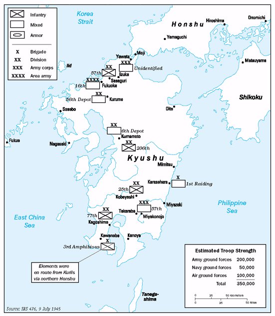
Operation Downfall - Estimated Troops 01
Wikimedia Commons

Post-Operations Map - Philippine Islands
1941–1947 · U.S. National Archives