

Oldham 1899 Map 2 memoirsofgeologi29geol 0551
Map 2 from
- Date
- December 31, 1899
- Mapmaker / publisher
- Oldham, Richard Dixon, 1858-1936
- Place
- earthquakes in India
- Archive
- Wikimedia Commons
- Type
- map
- Original size
- 2,643 × 2,077 pixels
Public domainsafest
Reason: its maker died more than 70 years ago.
Read from: Commons licence category: PD-old-70-expired; no CC BY, CC BY-SA, GFDL or deletion tag on the file page.
Credit line
"Oldham 1899 Map 2 memoirsofgeologi29geol 0551" (December 31, 1899). Oldham, Richard Dixon, 1858-1936, via Wikimedia Commons. Public domain. https://commons.wikimedia.org/wiki/File:Oldham_1899_Map_2_memoirsofgeologi29geol_0551.jpgNeed maps for a whole project? Add Find Any Map to Claude and ask for this one by its id: 257050.
More like this

A Statistical Account of Assam — Volume 2 Map
1875 · Wikimedia Commons
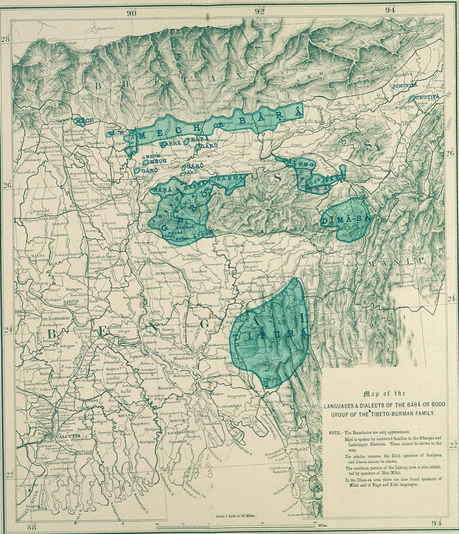
Map of the Languages and Dialects of the Bârâ or Bodo Group of the Tibeto-Burman Family
1903 · Wikimedia Commons

A Statistical Account of Assam — Volume 1 Map
1875 · Wikimedia Commons

1891 Skeleton map of Assam and Burmah (SoI)
1891 · Wikimedia Commons

Survey of India mapsheet 83, covers Assam and rest of Northeast India, with parts of adjoining regions of Myanmar and Bangladesh
1924 · Wikimedia Commons

Palaeontological memoirs and notes of H. Falconer, with a biographical sketch of the author.
1868 · Vol. I, Plate 2

Map of Lushai Tribes
1912 · Wikimedia Commons

Map showing Rukmininagar hill fortifications during the British period
1927 · Wikimedia Commons