

Numidia (Imperium Romanum)
Description: provinces of the Roman Empire (Imperium Romanum) Source: own work Date: December 2005 Author: --Immanuel Giel 12:56, 13 December 2005 (UTC) Other versions: none
- Date
- December 13, 2005
- Place
- Numidia
- Archive
- Wikimedia Commons
- Type
- map
- Original size
- 2,495 × 1,775 pixels
Public domain
Reason: public domain: self.
This status rests on the map's publication history, as researched by Wikimedia Commons. Check it before commercial use.
Read from: Commons licence category: PD-self; no CC BY, CC BY-SA, GFDL or deletion tag on the file page.
Credit line
"Numidia (Imperium Romanum)" (December 13, 2005). Wikimedia Commons. Public domain. https://commons.wikimedia.org/wiki/File:Numidia_(Imperium_Romanum).pngNeed maps for a whole project? Add Find Any Map to Claude and ask for this one by its id: 238718.
More like this

Carte Rome Diocletian baths
December 22, 2005 · Wikimedia Commons
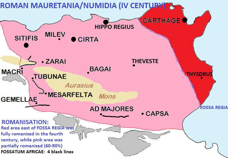
Fossaregiafossatumafricaemap
January 28, 2015 · Wikimedia Commons

Roman Africa
1879 · Wikimedia Commons

C. 395 Roman Provinces
c. 1911 · Wikimedia Commons
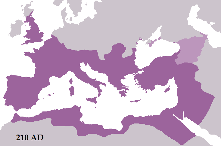
The Roman Empire in 210 AD after the conquests of emperor Septimius Severus. Roman territory is dark purple, Roman dependencies are in light purple. There are two areas of Roman dependencies: the Bosp
December 25, 2010 · Wikimedia Commons

Map Rome Hadrian mausoleum
February 28, 2006 · Wikimedia Commons

Prima Africae Tabula
1478 · Wikimedia Commons

Senatorial and Imperial provinces mid 2nd century
2009 · Wikimedia Commons