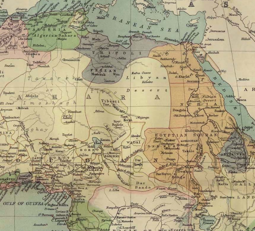

Northeast Africa 1885
Northeast Africa in 1885
- Date
- 1885
- Mapmaker / publisher
- F.R.G.S. John Bartholomew (1831 – 1893)
- Place
- Libya
- Archive
- Wikimedia Commons
- Type
- map
- Original size
- 860 × 779 pixels
Public domain
Reason: its maker died long enough ago that the copyright has expired.
This status rests on the map's publication history, as researched by Wikimedia Commons. Check it before commercial use.
Read from: Commons licence category: PD Old; no CC BY, CC BY-SA, GFDL or deletion tag on the file page.
Credit line
"Northeast Africa 1885" (1885). F.R.G.S. John Bartholomew (1831 – 1893), via Wikimedia Commons. Public domain. https://commons.wikimedia.org/wiki/File:Northeast_Africa_1885.jpgNeed maps for a whole project? Add Find Any Map to Claude and ask for this one by its id: 236505.
More like this

Map of a portion of Northeast Africa in the early 1880s, from Rand McNally and Co.'s fourth edition of "Indexed Atlas of the World", published in 1882 and reproduced in subsequent editions. Shown in p
1882 · Wikimedia Commons

Egypt, Arabia Petræa, Abyssinia, etc.
1885 · Library of Congress

DYE(1880) p519 Map of NORTH-EASTERN AFRICA
1880 · Wikimedia Commons

Africa, North-East Part
1897 · Wikimedia Commons

Africa North Eastern Sheet.
1855 · Wikimedia Commons

Bird's Eye View of the Soudan and Surrounding Countries
1884 · Wikimedia Commons

Spread of Mahdi revolt at End of 1885
1891 · Wikimedia Commons

Century Mag the Nile and NE Africa
1899 · Wikimedia Commons