

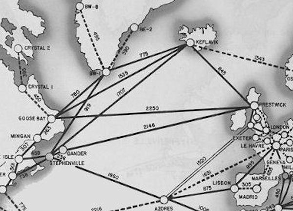
North Atlantic Area Map
during World War II
- Date
- 1947
- Mapmaker / publisher
- United States Bureau of Yards and Docks
- Place
- the Atlantic Ocean
- Archive
- Wikimedia Commons
- Type
- map
- Original size
- 2,904 × 1,818 pixels
Public domainsafest
Reason: a US government work.
Read from: Commons licence category: PD US Government; no CC BY, CC BY-SA, GFDL or deletion tag on the file page.
Credit line
"North Atlantic Area Map" (1947). United States Bureau of Yards and Docks, via Wikimedia Commons. Public domain. https://commons.wikimedia.org/wiki/File:North_Atlantic_Area_Map.jpgNeed maps for a whole project? Add Find Any Map to Claude and ask for this one by its id: 24055.
More like this

Western Atlantic Defense Zone
1947 · Wikimedia Commons

Map of the Mediterranean
1947 · Wikimedia Commons

Southwest Pacific Area Map
1947 · Wikimedia Commons

Mediterranean Area Map
1947 · Wikimedia Commons
North Atlantic Transport Route 1945
1945 · Wikimedia Commons

The Solomon Islands and Papua New Guinea
1947 · Wikimedia Commons

New Guinea in World War II
1947 · Wikimedia Commons

Map of AAF Ferrying command transport routes, June 1942 (before the first runway at Kindley Field in the British Imperial fortress of Bermuda became active in 1943).
1942 · Wikimedia Commons