
NDL use only, NOT FOR DISTRIBUTION
- Date
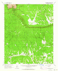
- 1962
- Mapmaker / publisher
- Geological Survey (U.S.)
- Place
- the Grand Canyon
- Archive
- Library of Congress (via Wikimedia Commons)
- Type
- map
- Sheets
- 6
- Original size
- 4,916 × 6,210 pixels
Public domainsafest
Reason: a US government work.
Read from: Commons licence category: PD US Government; no CC BY, CC BY-SA, GFDL or deletion tag on the file page.
Credit line
"NDL use only, NOT FOR DISTRIBUTION" (1962). Geological Survey (U.S.). Library of Congress, Geography and Map Division, via Wikimedia Commons. Public domain. https://commons.wikimedia.org/wiki/File:Arizona._LOC_99446126-1.jpgNeed maps for a whole project? Add Find Any Map to Claude and ask for this one by its id: 7971.
All 6 sheets
Each sheet links to its file at the archive; the image link is the full-size scan.


More like this

Edition statement varies on some sheets. NDL use only, NOT FOR DISTRIBUTION
1903 · 4 sheets

NDL use only, NOT FOR DISTRIBUTION
1988 · Plate 1

Grand Canyon, Arizona: USGS topographic map, 1:250,000 (1953–1960)
1953–1960 · 6 editions

Map of Grand Canyon National Park.
1926 · Library of Congress

Edition statement varies on some sheets. NDL use only, NOT FOR DISTRIBUTION
1891 · Arizona

Visitors' guide to Grand Canyon National Park, South Rim.
1957 · Library of Congress

Grand Canyon
1984 · Library of Congress
Grandview Point, Arizona: USGS topographic map, 1:62,500 (1962)
1962 · 2 editions