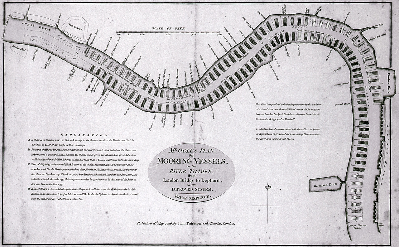

Mr Ogle's plan, for mooring vessels, in the River Thames, from London Bridge to Deptford, on an improved system. RMG E0455
Mr Ogle's plan, for mooring vessels, in the River Thames, from London Bridge to Deptford, on an improved system.Single sheet, hand coloured engraving. Scale in feet. A text panel explains the proposed improvements. This map illustrates the range and volume of trade to London. Ogle's plan was an attempt to solve the problem of overcrowding caused by the doubling of London's seaborne trade since 1760. By the time of this chart, nearly 3,500 foreign-going vessels were sailing to London each year. The role of the navy in safeguarding this trade during the French revolutionary and Napoleonic wars was of vital importance. In the event this improved system was passed over in favour of the more ambitious West India Docks and Wapping Docks schemes. Mr Ogles Plan for Mooring Vessels in the River Thames from London Bridge to Deptford
- Date
- 1796
- Mapmaker / publisher
- Edward Ogle; John Fairburn
- Place
- London
- Archive
- Wikimedia Commons
- Type
- chart
- Original size
- 1,280 × 792 pixels
Public domainsafest
Reason: its maker died more than 100 years ago.
Read from: Commons licence category: PD-old-100-expired; no CC BY, CC BY-SA, GFDL or deletion tag on the file page.
Credit line
"Mr Ogle's plan, for mooring vessels, in the River Thames, from London Bridge to Deptford, on an improved system. RMG E0455" (1796). Edward Ogle; John Fairburn, via Wikimedia Commons. Public domain. https://commons.wikimedia.org/wiki/File:Mr_Ogle%27s_plan,_for_mooring_vessels,_in_the_River_Thames,_from_London_Bridge_to_Deptford,_on_an_improved_system._RMG_E0455.jpgNeed maps for a whole project? Add Find Any Map to Claude and ask for this one by its id: 291737.
More like this

Mr Ogle's plan, for mooring vessels, in the River Thames, from London Bridge to Deptford, on an improved system. RMG F0074
1796 · Wikimedia Commons

Chart of the River Thames from London to the Nore, Margate and the Downs, North, Middle and South Channels, from a survey taken in 1789 and 90 RMG F0204
1790 · Wikimedia Commons

A new and correct chart from the Isle of Dogs, to Prittlewell, and the Nore RMG F8050
1797 · Wikimedia Commons

Vray pourtraict de la riviere tres renomde de Londres, auetrement nomed, la Tamihe, merveilleusement bouched de hableus ds banqs, avec pluseurs flexueie et restdctiens, eseudne insgnes debam laditte ville de Londres de plus RMG F0291
c. 1606 · 2 sheets

A chart of the River Thames from London Bridge to Woolwich Warren (CBL Wep 4095.83)
1802 · Wikimedia Commons

ReveleyThamesscheme1796
Wikimedia Commons

A chart of the river Thames from London bridge to Woolwich warren
1799 · Wikimedia Commons

(A) EDWARD OGLES' PLAN
1877 · Wikimedia Commons