

Morris County, New Jersey
"October 1986." Alternate title in right lower margin: Morris Co., N.J.: N4038.5-W7415/27X39, 1978. UTM and state grids. Includes notes. "4-R-40021."
- Date
- 1986
- Mapmaker / publisher
- Geological Survey (U.S.); National Cartographic Center (U.S.)
- Place
- New Jersey
- Archive
- Library of Congress (via Wikimedia Commons)
- Type
- map
- Original size
- 7,004 × 7,057 pixels
Public domainsafest
Reason: a US government work.
Read from: Commons licence category: PD US Government; no CC BY, CC BY-SA, GFDL or deletion tag on the file page.
Credit line
"Morris County, New Jersey" (1986). Geological Survey (U.S.); National Cartographic Center (U.S.). Library of Congress, Geography and Map Division, via Wikimedia Commons. Public domain. https://commons.wikimedia.org/wiki/File:Morris_County,_New_Jersey_LOC_87694230.jpgNeed maps for a whole project? Add Find Any Map to Claude and ask for this one by its id: 18339.
More like this

Passaic County, New Jersey
1986 · Library of Congress

Hunterdon County, New Jersey
1986 · Library of Congress

Somerset County, New Jersey
1986 · Library of Congress

Sussex County, New Jersey
1986 · Library of Congress

Essex County, New Jersey
1986 · Library of Congress

Bergen County, New Jersey
1986 · Library of Congress
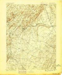
Morristown, New Jersey: USGS topographic map, 1:62,500 (1888–1906)
1888–1906 · 10 editions

Warren County, New Jersey
1985 · Library of Congress