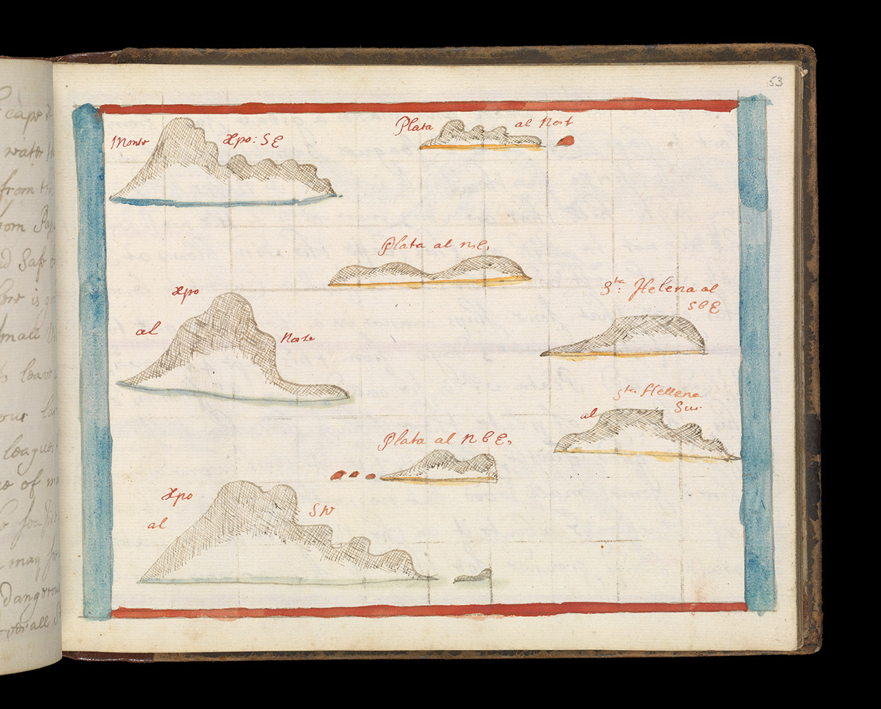

Montechristi, Isla de la Plata and Punta Santa Elena RMG L6957-104
Montechristi, Isla de la Plata and Punta Santa Elena Bound sheet. Col. ms. Additional Places: Ecuador. Contents Note: Views from different directions. >From a book of sailing directions of 110ff: 'The South Sea Waggoner shewing the making & bearing of all the coasts from California to the Streights of Le Maire done from the Spanish originall by Basil Ringrose'. The charts all have a square pencil grid for making copies. Montechristi, Isla de la Plata and Punta Santa Elena. A Waggoner - 'Shewing the making and bearing of all the coasts from California to the Streights of Le Maire done from the Spanish original by Basil Ringrose' Text and drawings.P/32(53)
- Date
- 1682
- Mapmaker / publisher
- Ringrose, Basil
- Place
- Ecuador
- Archive
- Wikimedia Commons
- Type
- chart
- Original size
- 1,280 × 1,031 pixels
Public domainsafest
Reason: its maker died more than 100 years ago.
Read from: Commons licence category: PD-old-100-expired; no CC BY, CC BY-SA, GFDL or deletion tag on the file page.
Credit line
"Montechristi, Isla de la Plata and Punta Santa Elena RMG L6957-104" (1682). Ringrose, Basil, via Wikimedia Commons. Public domain. https://commons.wikimedia.org/wiki/File:Montechristi,_Isla_de_la_Plata_and_Punta_Santa_Elena_RMG_L6957-104.jpgNeed maps for a whole project? Add Find Any Map to Claude and ask for this one by its id: 305907.
More like this

Montechristi, Isla de la Plata and Punta Santa Elena RMG F1467
1682 · Wikimedia Commons

Bahia de Nuestra Senora and Chanaral RMG L6957-178
1682 · Wikimedia Commons

Bahia Moreno and Antofagasta RMG L6957-176
1682 · Wikimedia Commons

Cerro Azul RMG L6957-150
1682 · Wikimedia Commons

Bahia Elena RMG L6957-054
1682 · Wikimedia Commons

Cerro Azul RMG F1489
1682 · Wikimedia Commons

Bahia de San Nicolas and San Juan RMG L6957-158
1682 · Wikimedia Commons

Cabo Corrientes RMG L6957-014
1682 · Wikimedia Commons