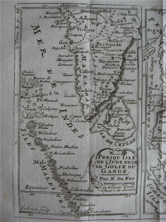

"Mogol," by Nicholas de Fer and J. Robbe, from 'Methode pour apprende facilement la geographie', Paris, 1721: *the whole map*: *northwest*; *northeast*; *southwest*; *southeast* (shown above); *a larg
- Date
- 1721
- Mapmaker / publisher
- Nicholas de Fer and J. Robbe
- Place
- India
- Archive
- Wikimedia Commons
- Type
- map
- Original size
- 576 × 768 pixels
Public domain
Reason: its maker died long enough ago that the copyright has expired.
This status rests on the map's publication history, as researched by Wikimedia Commons. Check it before commercial use.
Read from: Commons licence category: PD Old; no CC BY, CC BY-SA, GFDL or deletion tag on the file page.
Credit line
""Mogol," by Nicholas de Fer and J. Robbe, from 'Methode pour apprende facilement la geographie', Paris, 1721: *the whole map*: *northwest*; *northeast*; *southwest*; *southeast* (shown above); *a larg" (1721). Nicholas de Fer and J. Robbe, via Wikimedia Commons. Public domain. https://commons.wikimedia.org/wiki/File:Southindia1721.jpgNeed maps for a whole project? Add Find Any Map to Claude and ask for this one by its id: 255246.
More like this

Inde South Asia Map in 1721 by Nicholas de Fer and J. Robbe
1721 · Wikimedia Commons

Indostan - the kingdoms in South Asia by Nicolas de Fer 1721
1721 · Wikimedia Commons

De Fer's corresponding miniature map of South India and Southeast Asia, c.1685
1685 · Wikimedia Commons

North India, from a miniature map by Nicolas de Fer, c.1685 onwards
1685 · Wikimedia Commons

Map of the Mogul empire, 1719
1719 · Wikimedia Commons

A closer view of south part from "L'Atlas en Abrege ou Nouvelle Description du Monde
1692 · Wikimedia Commons

India, or the Mogul's Empire.
1701 · New York Public Library

Carte des Côtes de Malabar et de Coromandel." by Guillaume de l'Isle, Paris, 1723 08
1723 · Wikimedia Commons