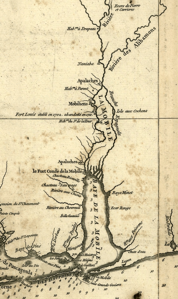

Mobile in 1732
A detail of Anville's 1732 map of Louisiana showing Mobile Bay, the Mobile colony, and surrounding Native American settlements and villages.
- Date
- 1732–1752
- Place
- Mobile, Alabama
- Archive
- Library of Congress (via Wikimedia Commons)
- Type
- map
- Original size
- 592 × 996 pixels
Public domain
Reason: a US government work.
This status rests on the map's publication history, as researched by Wikimedia Commons. Check it before commercial use.
Read from: Commons licence category: PD US; no CC BY, CC BY-SA, GFDL or deletion tag on the file page.
Credit line
"Mobile in 1732" (1732–1752). Library of Congress, Geography and Map Division, via Wikimedia Commons. Public domain. https://commons.wikimedia.org/wiki/File:Mobile_in_1732.jpgNeed maps for a whole project? Add Find Any Map to Claude and ask for this one by its id: 18272.
More like this

Carte de la Louisiane par le Sr. d'Anville.
1752 · Library of Congress

Map of Louisiana, from d'Anville's atlas.
1788 · Library of Congress

Plan du Fort Condé de la Mobille, marqué en rouge dans l'Etat quil est presentement 1743, avec la partie de l'augementation (i.e. l'augmentation) proposée, marqué en jeaune (i.e. jaune).
1743 · Library of Congress

Carte de la Louisiane et du cours du Mississipi avec les colonies anglaises
1782 · New York Public Library

Carte d'une partie du cours de la riviere de la Mobille et de celle des Chicachas.
1763 · Library of Congress

A map of Louisiana, with the course of the Missisipi, and the adjacent rivers, the nations of the natives, the French establishments and the mines; by the author of ye History of that colony. 1757.
1763 · Library of Congress

Carte particulière d'une partie de la Louisianne ou les fleuve et rivierres (i.e. rivières) onts etés relevé a l'estime & les routtes (i.e. routes) par terre relevé & mesurées aux pas, par les Srs.
1743 · Library of Congress

(Carte particulière d'une partie de la Louisianne ou les fleuve et rivierres (i.e. rivières) onts etés relevé a l'estime & les routtes (i.e. routes) par terre relevé & mesurées aux pas, par les Srs.
1743 · Library of Congress