

Milliken's Bend - Jackson;Vicksburg
Map of the country between Milliken's Bend, La. and Jackson, Miss. showing the routes followed by the Army of the Tennessee under the command of Maj. Gen. U.S. Grant, U.S. Vls. in its march from Milliken's Bend to rear of Vicksburg in April and May 1863. Compiled, surveyed and drawn under the direction of Lt. Col. J.H. Wilson. Drawn by Maj. Otto H. Matz. and 1st Lieut. L. Helmle
- Date
- 1895
- Mapmaker / publisher
- Otto H. Matz; United States War Department
- Place
- Louisiana in the American Civil War
- Archive
- Wikimedia Commons
- Type
- map
- Original size
- 1,244 × 936 pixels
Public domain
Reason: a US government work.
This status rests on the map's publication history, as researched by Wikimedia Commons. Check it before commercial use.
Read from: Commons licence category: PD US; no CC BY, CC BY-SA, GFDL or deletion tag on the file page; permission field: No known restrictions on publication..
Credit line
"Milliken's Bend - Jackson;Vicksburg" (1895). Otto H. Matz; United States War Department, via Wikimedia Commons. Public domain. https://commons.wikimedia.org/wiki/File:Milliken%27s_Bend_-_Jackson;Vicksburg.jpgNeed maps for a whole project? Add Find Any Map to Claude and ask for this one by its id: 411.
More like this

Map of the country between Millikens Bend, La. and Jackson, Miss. shewing the routes followed by the Army of the Tennessee under the command of Maj. Genl. U.S. Grant, U.S. Vols. in its march from
1876 · Library of Congress

Map of the country between Millikens Bend, La. and Jackson, Miss. shewing the routes followed by the Army of the Tennessee under the command of Maj. Genl. U.S. Grant, U.S. Vols. in its march from
1876 · Library of Congress

Map illustrating the operations of U.S. Forces against Vicksburg
1863 · Library of Congress

Map illustrating the operations of U.S. Forces against Vicksburg
1863 · Library of Congress
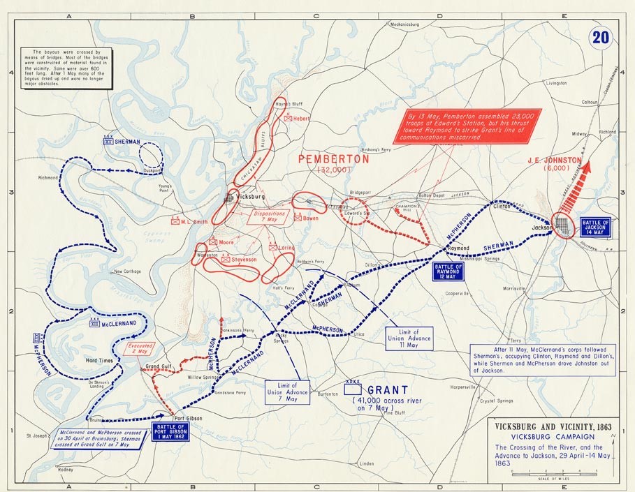
Grant's March through Louisiana and crossing
Wikimedia Commons

Map illustrating the operations of the U.S. forces against Vicksburg.
1863 · Library of Congress

(Map of the environs of Vicksburg and Jackson, Mississippi.).
1863 · Library of Congress

New Orleans to Vicksburg
1863 · Library of Congress