

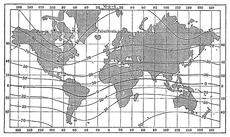
Meyer‘s Zeitungsatlas 088 – Karte der magnetischen Meridiane und Parallel-Kreise
nach den Beobachtungen über die Declination der Magnetnadel in stereographischer Polar-Projection als Ergänzung der auf einem anderen Blatte nach Marcator's Projection gegebenen Darstellung
- Date
- 1850
- Mapmaker / publisher
- entworfen von L. I. Duperrey, Schiffs-Kapitän der französ. Marine
- Place
- the world with orthographic projection
- Archive
- Wikimedia Commons
- Type
- map
- Original size
- 7,393 × 6,265 pixels
Public domain
Reason: its maker died long enough ago that the copyright has expired.
This status rests on the map's publication history, as researched by Wikimedia Commons. Check it before commercial use.
Read from: Commons licence category: PD Old; no CC BY, CC BY-SA, GFDL or deletion tag on the file page.
Credit line
"Meyer‘s Zeitungsatlas 088 – Karte der magnetischen Meridiane und Parallel-Kreise" (1850). entworfen von L. I. Duperrey, Schiffs-Kapitän der französ. Marine, via Wikimedia Commons. Public domain. https://commons.wikimedia.org/wiki/File:Meyer%E2%80%98s_Zeitungsatlas_088_%E2%80%93_Karte_der_magnetischen_Meridiane_und_Parallel-Kreise.jpgNeed maps for a whole project? Add Find Any Map to Claude and ask for this one by its id: 144484.
More like this

Meyer‘s Zeitungsatlas, Karte 1: Die oestliche und westliche Halbkugel der Erde
1849 · Meyer‘s Zeitungsatlas 001

Meyer‘s Zeitungsatlas 060 – Erdkarte
1849 · Wikimedia Commons

Meyer‘s Zeitungsatlas 064 – Das System unserer Sonne
1849 · Wikimedia Commons
Meyers b11 s0088 b1
c. 1885 · Wikimedia Commons

Meyers b11 s0087 b1
c. 1885 · Wikimedia Commons

Meyers b11 s0085 b3
c. 1885 · Wikimedia Commons

Meyer‘s Zeitungsatlas 099 – Physikalische Karte vom Indischen Meere
1850 · Wikimedia Commons

Meyer‘s Zeitungsatlas 089 – Windkarte der Erde
1850 · Wikimedia Commons