

Matomkin Inlet, Virginia
Depths shown by soundings. Lower left corner of the copy is wanting. From its Report of the Superintendent of the Coast Survey, showing the progress of the survey during the year 1862 (Washington, Government Printing Office, 1864). Map 16. "No. 378" is in the upper left corner. Title changed to: "Matomkin Inlet, Virginia"; similar to (2nd ed.), 584.5
- Date
- 1862
- Mapmaker / publisher
- United States Coast Survey
- Place
- Virginia
- Archive
- Library of Congress (via Wikimedia Commons)
- Type
- map
- Original size
- 6,780 × 7,474 pixels
Public domainsafest
Reason: its maker died more than 100 years ago.
Read from: Commons licence category: PD-old-100-expired; no CC BY, CC BY-SA, GFDL or deletion tag on the file page.
Credit line
"Matomkin Inlet, Virginia" (1862). United States Coast Survey. Library of Congress, Geography and Map Division, via Wikimedia Commons. Public domain. https://commons.wikimedia.org/wiki/File:Matomkin_Inlet,_Virginia_LOC_2006626054.jpgNeed maps for a whole project? Add Find Any Map to Claude and ask for this one by its id: 18057.
More like this

Metomkin Inlet, Virginia.
1862 · Library of Congress

Preliminary chart of the Atlantic coast - from the entrance of Chesapeake Bay to Ocracoke Inlet
1862 · Library of Congress

Preliminary chart of Hatteras Inlet, North Carolina
1862 · Library of Congress

Preliminary chart of North Landing River (head of Currituck Sound), Virginia & N. Carolina.
1861 · Library of Congress
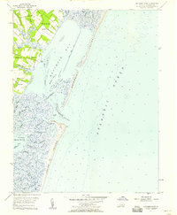
Metomkin Inlet, Virginia: USGS topographic map, 1:24,000 (1957–1968)
1957–1968 · 4 editions

Outline map of eastern Virginia and the Chesapeake Bay region.
1882 · Library of Congress

Oregon Inlet, N. Carolina
1862 · Library of Congress

Southern Virginia and northern North Carolina
1865 · United States Coast Survey