

Mappe der Schlacht in Frankreich-Juni 1940
- Date
- 1943
- Place
- France
- Archive
- Wikimedia Commons
- Type
- map
- Original size
- 2,476 × 2,284 pixels
Public domain
Reason: published outside the US before 1996 and already public domain in its home country then.
This status rests on the map's publication history, as researched by Wikimedia Commons. Check it before commercial use.
Read from: Commons licence category: PD-1996; no CC BY, CC BY-SA, GFDL or deletion tag on the file page.
Credit line
"Mappe der Schlacht in Frankreich-Juni 1940" (1943). Wikimedia Commons. Public domain. https://commons.wikimedia.org/wiki/File:Mappe_der_Schlacht_in_Frankreich-Juni_1940.jpgNeed maps for a whole project? Add Find Any Map to Claude and ask for this one by its id: 23344.
More like this

4June-12June1940-Fall Rot
Wikimedia Commons
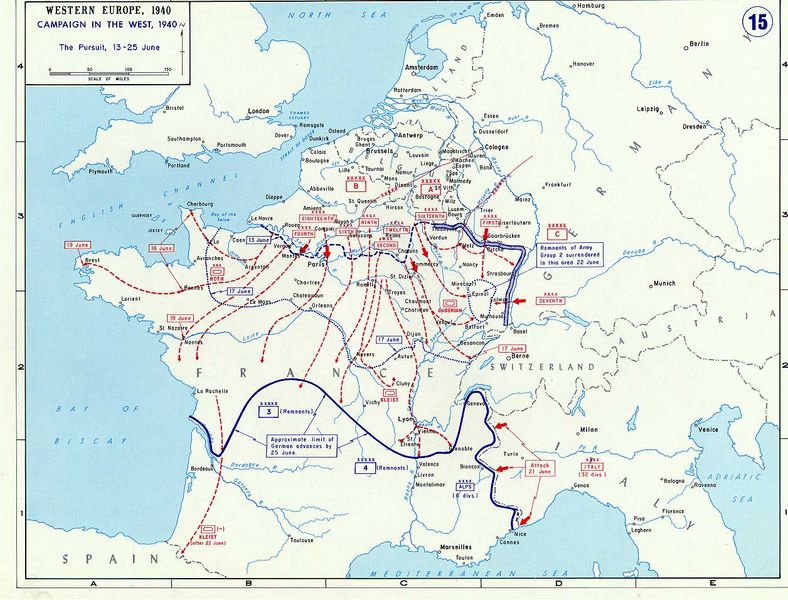
German offensive of june 1940, which led to defeat of France in WWII
1940 · Wikimedia Commons

The Conquest and liberation of France
1944 · Wikimedia Commons

1940FaguoLiuYue
2006 · Wikimedia Commons

(June 13, 1944), HQ Twelfth Army Group situation map.
June 13, 1944 · Library of Congress

(June 10, 1944), HQ Twelfth Army Group situation map.
June 10, 1944 · Library of Congress

(June 19, 1944), HQ Twelfth Army Group situation map.
June 19, 1944 · Library of Congress

(June 25, 1944), HQ Twelfth Army Group situation map.
June 25, 1944 · Library of Congress