

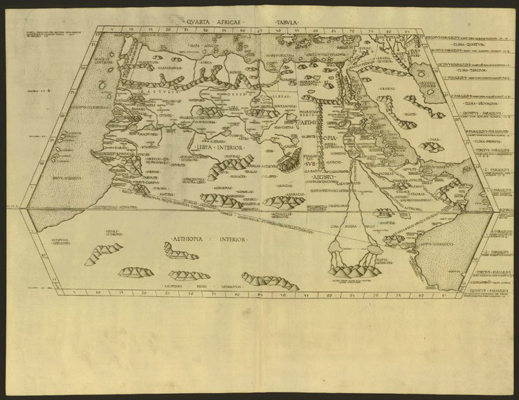
Mapa Ptolomeo Detalle Atlantico
Detail of the Atlantic coast of Africa in the Ptolemy world map. Copy prepared by Giovanni Rhosos for Cardinal Bessarion around 1454.
- Date
- 1450s
- Mapmaker / publisher
- Hispalois
- Place
- Africa
- Archive
- Wikimedia Commons
- Type
- map
- Original size
- 1,200 × 1,600 pixels
Public domain
Reason: its maker died long enough ago that the copyright has expired.
This status rests on the map's publication history, as researched by Wikimedia Commons. Check it before commercial use.
Read from: Commons licence category: PD Old; no CC BY, CC BY-SA, GFDL or deletion tag on the file page.
Credit line
"Mapa Ptolomeo Detalle Atlantico" (1450s). Hispalois, via Wikimedia Commons. Public domain. https://commons.wikimedia.org/wiki/File:Mapa_Ptolomeo_Detalle_Atlantico.jpgNeed maps for a whole project? Add Find Any Map to Claude and ask for this one by its id: 234440.
More like this

The Cosmography of Claudius Ptolemaeus the Alexandrian (Cosmographia Claudii Ptolomaei Alexandrini)
1467 · Africa

The Cosmography of Claude Ptolemy the Alexandrian (Cosmographia Claudii Ptolomaei Alexandrini)
1467 · North Africa

The Cosmography of Claudius Ptolemy the Alexandrian (Cosmographia Claudii Ptolomaei Alexandrini)
1467 · Spain

1563 lazaro luis 04 atlantic nord
1563 · Wikimedia Commons

Lázaro Luis 1563
1560s · Wikimedia Commons
Quarta Africae Tabula
Wikimedia Commons

Cosmography (Cosmographia Claudii Ptolomaei Alexandrini)
1467 · Wikimedia Commons

Atlas nautique de l'océan Atlantique Nord-Est, de la mer Méditerranée et de la mer Noire / Gratiosus Benincasa Anchonitanus composuit Rome Anno domini MCCCCLXVII
1467 · Africa, plate 2 of 9