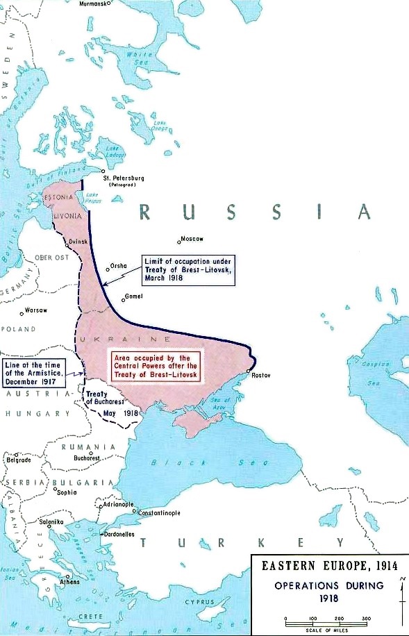

Map Treaty of Brest-Litovsk-en
Taken from the campaign series, made public by the US-Army under www.dean.usma.edu The picture is public domain. Map showing the territorial results of the armistice between Bolshevist Russia and the Central Powers.
- Mapmaker / publisher
- Department of History, United States Military Academy
- Archive
- Wikimedia Commons
- Type
- map
- Original size
- 614 × 954 pixels
Public domainsafest
Reason: a US government work (US Army).
Read from: Commons licence category: PD US Army; no CC BY, CC BY-SA, GFDL or deletion tag on the file page.
Credit line
"Map Treaty of Brest-Litovsk-en". Department of History, United States Military Academy, via Wikimedia Commons. Public domain. https://commons.wikimedia.org/wiki/File:Map_Treaty_of_Brest-Litovsk-en.jpgNeed maps for a whole project? Add Find Any Map to Claude and ask for this one by its id: 22149.
More like this

Armisticebrestlitovsk crop
Wikimedia Commons

Brest-Litovsk Siebert
1918 · Wikimedia Commons

Post WWI Conflict Map In New-York Tribune November 9 1919 Page 26
November 9, 1919 · Wikimedia Commons

Ostfront 1918
1918 · Wikimedia Commons

Map of the Eastern Front in the time of Kerensky Offensive in summer of 1917.
1917 · Wikimedia Commons

Berestia, 1917, map
1917 · Wikimedia Commons

Masurian Lakes Sep1914
c. 1910 · Wikimedia Commons

Eastern front October 1, 1915
1915 · Wikimedia Commons