

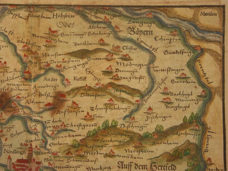
Map Swabia small 1600
Münster on Germany and its area-- maps, views, sights (many with modern hand-coloring) == *map of the northern Rhine* (1600): *northwest*; *northeast*; *southwest*; *southeast* == *map of the central Rhine* (1600): *northwest*; *northeast*; *southwest*; *southeast* == *map of Germany* (1600): *northwest*; *northeast*; *southwest*; *southeast* == *map of Germany* (1628) == *map of Algau* (1600) == *map of Bavaria-Franconia* (1600) == *map of Bavaria-Franconia* (1600): *northwest*; *northeast*; *southwest*; *southeast* == *map of the Berlin region* (1600) == *map of Breisgau* (1600) == *map of the Eifel region* (1600) == *map of Frankfurt* (1600): *left*; *right*; *a detail* == *map of Frieburg* (1600): *upper left*; *upper right*; *lower left*; *lower right* == *map of Friesland* (1600); *a closer view* == *map of Hessen and Thuringia* (1600) == *map of Sarmatia* (1600) == *map of Swabia, small* (1600) == *map of Swabia, Bavaria, Odenwald* (1600): *northwest*; *northeast*; *southwest*; *southeast* == *map of Swabia* (1600): *northwest*; *northeast*; *southwest*; *southeast*; *a detail* == *map of Austria* (1600) == *Amberg* (1600); *a closer view* == *Augsburg* (1600); *a clo
- Date
- 1544–1628
- Place
- Swabia
- Archive
- Wikimedia Commons
- Type
- map
- Original size
- 800 × 600 pixels
Public domain
Reason: its maker died long enough ago that the copyright has expired.
This status rests on the map's publication history, as researched by Wikimedia Commons. Check it before commercial use.
Read from: Commons licence category: PD Old; no CC BY, CC BY-SA, GFDL or deletion tag on the file page.
Credit line
"Map Swabia small 1600" (1544–1628). Wikimedia Commons. Public domain. https://commons.wikimedia.org/wiki/File:Map_Swabia_small_1600.jpgNeed maps for a whole project? Add Find Any Map to Claude and ask for this one by its id: 244317.
More like this

Map of Swabia
1544–1628 · Wikimedia Commons
Map of Swabia SW 1600
1544–1628 · Wikimedia Commons

Map of Swabia SE 1600
1544–1628 · Wikimedia Commons

Map of Swabia NW 1600
1544–1628 · Wikimedia Commons

Map of Swabia NE 1600
1544–1628 · Wikimedia Commons

Map of Swabia, Bavaria, Odenwald
1544–1628 · Wikimedia Commons

Map of Swabia, Bavaria, Odenwald SW 1600
1544–1628 · Wikimedia Commons

Map of Swabia a detail 1600
1544–1628 · Wikimedia Commons