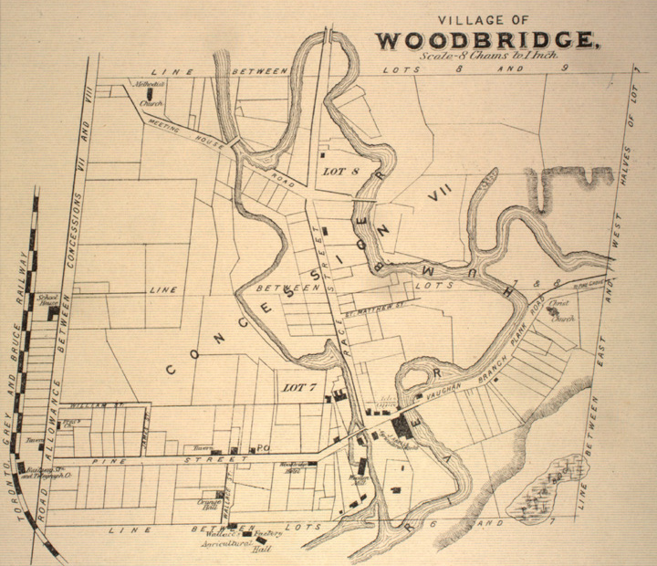

Map of Woodbridge, Ontario, 1878
A map depicting the western half of lots 7 and 8 of Concession VII in Woodbridge, a community in York County, Ontario. On the left, the rail line Toronto Grey and Bruce Railway is labelled. A western branch of the Humber River is prominent.
- Date
- 1878
- Mapmaker / publisher
- Miles & Co
- Place
- Ontario
- Archive
- Wikimedia Commons
- Type
- map
- Original size
- 720 × 620 pixels
Public domain
Reason: public domain: Canada.
This status rests on the map's publication history, as researched by Wikimedia Commons. Check it before commercial use.
Read from: Commons licence category: PD Canada; no CC BY, CC BY-SA, GFDL or deletion tag on the file page.
Credit line
"Map of Woodbridge, Ontario, 1878" (1878). Miles & Co, via Wikimedia Commons. Public domain. https://commons.wikimedia.org/wiki/File:Map_of_Woodbridge,_Ontario,_1878.jpgNeed maps for a whole project? Add Find Any Map to Claude and ask for this one by its id: 295679.
More like this

Insurance Plan of London Western District Vol. A: sheet 7
1901 · Wikimedia Commons

Insurance Plan of London North District Vol. E: sheet 7-1
1893 · Wikimedia Commons

Insurance Plan of London West Vol. A: sheet 7
1891 · Wikimedia Commons

Insurance Plan of London West, North West Vol. B: sheet 7-1
1892 · Wikimedia Commons

Insurance Plan of London West Vol. A: sheet 8-3
1891 · Wikimedia Commons

Insurance Plan of London North District Vol. E: sheet 7-2
1893 · Wikimedia Commons

Insurance Plan of London Western District Vol. A: sheet 38-2
1901 · Wikimedia Commons

Insurance Plan of London West, North West Vol. B: sheet 7-2
1892 · Wikimedia Commons