

Map of the Soviet operational plan for the Far East, early 1942
- Date
- March 26, 2017
- Place
- Siberia
- Archive
- Wikimedia Commons
- Type
- map
- Original size
- 816 × 711 pixels
CC0safest
Reason: CC0: dedicated to the public domain.
Read from: Commons licence category: CC-Zero; no CC BY, CC BY-SA, GFDL or deletion tag on the file page.
Credit line
"Map of the Soviet operational plan for the Far East, early 1942" (March 26, 2017). Wikimedia Commons. CC0. https://commons.wikimedia.org/wiki/File:KantokuenSovWikiMap.pngNeed maps for a whole project? Add Find Any Map to Claude and ask for this one by its id: 24743.
More like this

Map of Japanese Kantokuen Plan against the Soviet Union
March 26, 2017 · Wikimedia Commons
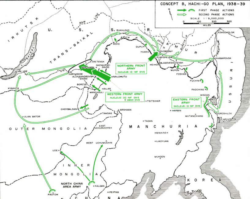
Hachi-Go Concept B, 1938-39
1955 · Wikimedia Commons

Japanese "Tunghua Redoubt" defense plan
September 30, 1954 · Wikimedia Commons

Ussuri Breakthrough Zones
1955 · Wikimedia Commons

Japanese First Area Army's defense plan 1945
April 6, 1954 · Wikimedia Commons

Axis Powers Operational Plans of Expansion (without codenames)
October 14, 2024 · Wikimedia Commons

Axis Powers Operational Plans of Expansion (with codenames)
October 13, 2024 · Wikimedia Commons

Manchuria 1945
1945 · Wikimedia Commons