

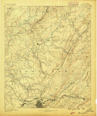
Map of The Crescent, Birmingham 1888-9
Ordnance Survey map of The Crescent, Birmingham, England.
- Date
- 1888–1889
- Mapmaker / publisher
- Ordnance Survey
- Place
- Birmingham
- Archive
- Wikimedia Commons
- Type
- map
- Original size
- 699 × 416 pixels
Public domain
Reason: a US government work.
This status rests on the map's publication history, as researched by Wikimedia Commons. Check it before commercial use.
Read from: Commons licence category: PD US; no CC BY, CC BY-SA, GFDL or deletion tag on the file page.
Credit line
"Map of The Crescent, Birmingham 1888-9" (1888–1889). Ordnance Survey, via Wikimedia Commons. Public domain. https://commons.wikimedia.org/wiki/File:Map_of_The_Crescent,_Birmingham_1888-9.jpgNeed maps for a whole project? Add Find Any Map to Claude and ask for this one by its id: 245417.
More like this

Map of The Crescent, Birmingham 1904-5
1904–1905 · Wikimedia Commons

Hand Coloured Map Descriptive of London Poverty 1898-1899 Sheet 88 - Chelsea Hospital, Battersea Park, Pimlico, Westminster, Nine Elms
1894–1899 · Wikimedia Commons

Sanborn Fire Insurance Map from Birmingham, Jefferson County, Alabama, 1888, volume 2
1888 · 29 sheets

Hand Coloured Map Descriptive of London Poverty 1898-1899 Sheet 29 - Upper Holloway, South Hornsey, Islington, Lower Holloway and Highbury
1894–1899 · Wikimedia Commons

Hand Coloured Map Descriptive of London Poverty 1898-1899 Sheet 39 - Barnsbury, Canonbury, Highbury Fields
1894–1899 · Wikimedia Commons

Hand Coloured Map Descriptive of London Poverty 1898-1899 Sheet 49 - Marylebone, Regent's Park, Euston, St Pancras, Somers Town
1894–1898 · Wikimedia Commons

Hand Coloured Map Descriptive of London Poverty 1898-1899 Sheet 89 - Kennington, Vauxhall
1894–1899 · Wikimedia Commons
Birmingham, Alabama: USGS topographic map, 1:125,000 (1889–1907)
1889–1907 · 9 editions