

MAP OF THE AUTHOR'S ROUTE
- Date
- 1878
- Place
- Denmark
- Archive
- Wikimedia Commons
- Type
- map
- Original size
- 3,847 × 3,871 pixels
Public domainsafest
Reason: its maker died more than 70 years ago.
Read from: Commons licence category: PD-old-70-expired; no CC BY, CC BY-SA, GFDL or deletion tag on the file page.
Credit line
"MAP OF THE AUTHOR'S ROUTE" (1878). Wikimedia Commons. Public domain. https://commons.wikimedia.org/wiki/File:MAP_OF_THE_AUTHOR%27S_ROUTE.jpgNeed maps for a whole project? Add Find Any Map to Claude and ask for this one by its id: 251798.
More like this

TB(1895) p593 Map showing the Route to Kolguev Island and retour
1895 · Wikimedia Commons

Sweden, Norway & Denmark.
1585 · Wikimedia Commons
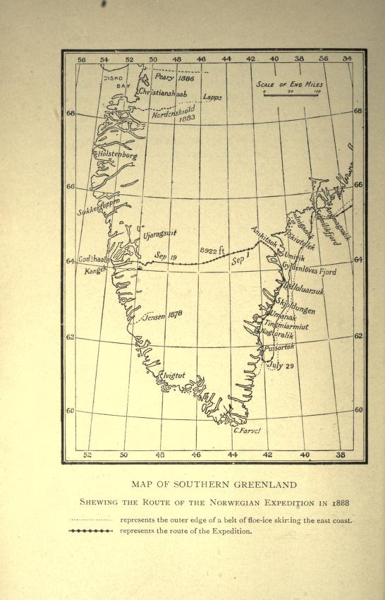
Map showing route of Nansen's first crossing of Greenland, 1888
1888 · Wikimedia Commons

(1811) MAP OF SWEDEN, NORWAY ect
1811 · Wikimedia Commons

Russia in Europe, Sweden, and Norway; Map of Denmark; Map of Holland and Belgium.
1863 · New York Public Library

Chart illustrating Lieut.Hooper's Narrative, showing the country of the Tuski, and the progress of the boat expedition
1853 · Wikimedia Commons

MURPHY(1883) p008 Map of Ireland, showing Cromwell's Route
1883 · Wikimedia Commons

Scandinavie et Danemark Itinéraire de M. Koechlin Schwartz
1882 · Wikimedia Commons