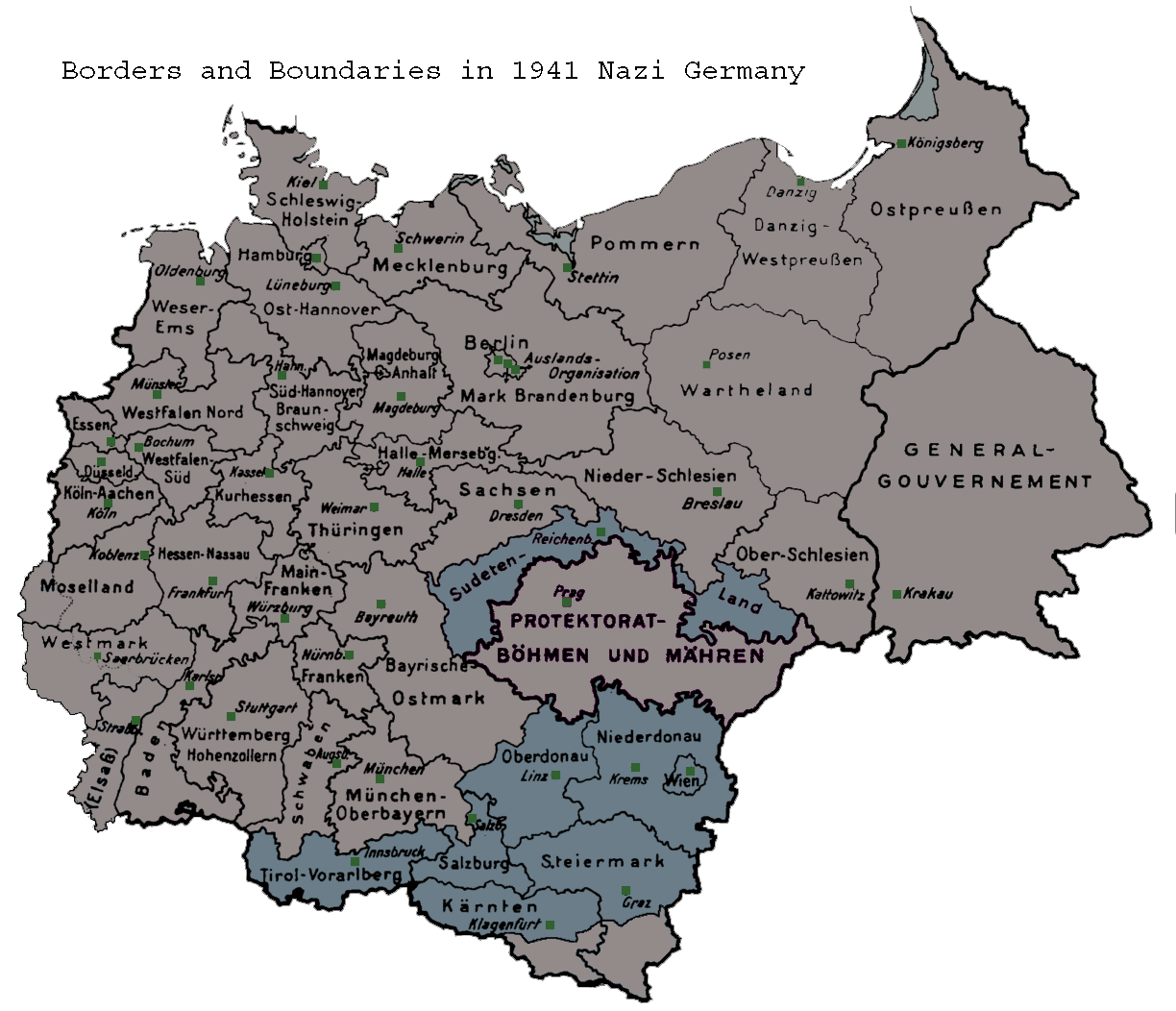

Map of the administrative districts in territories under the control of Nazi Germany in 1941. This map shows administration borders and has been retouched from the original Wiki Commons image. Specifi
- Date
- May 26, 2006
- Place
- subdivisions of Nazi Germany
- Archive
- Wikimedia Commons
- Type
- map
- Original size
- 1,224 × 1,052 pixels
Public domain
Reason: public domain: user.
This status rests on the map's publication history, as researched by Wikimedia Commons. Check it before commercial use.
Read from: Commons licence category: PD-user; no CC BY, CC BY-SA, GFDL or deletion tag on the file page.
Credit line
"Map of the administrative districts in territories under the control of Nazi Germany in 1941. This map shows administration borders and has been retouched from the original Wiki Commons image. Specifi" (May 26, 2006). Wikimedia Commons. Public domain. https://commons.wikimedia.org/wiki/File:NaziGaue.pngNeed maps for a whole project? Add Find Any Map to Claude and ask for this one by its id: 24312.
More like this

Greater Germany. Administrative divisions. July 1, 1944. 100 kms
1944 · Wikimedia Commons

Nazi Germany Provinces 1944
May 14, 2025 · Wikimedia Commons

Map from "The Handbook on German Military Forces (TM-E 30-451)" a publication of the War departement, Military Intelligence Division, March 1945.
1945 · Wikimedia Commons

Greater Germany ". Major administrative divisions. July 1. 1944. 100 kms
1944 · Wikimedia Commons

Map of Nazi Germany 1942
August 8, 2026 · Wikimedia Commons

Simulation eines „deutschen Schutzgebietes“ (Konzept von 1941)
April 18, 2017 · Wikimedia Commons

Greater Germany Kreis boundaries. July 1, 1944. 125 kms
1945 · Wikimedia Commons

Ukr 1941-1942 annotations colours dnieper borders(var.2a)
July 12, 2025 · Wikimedia Commons