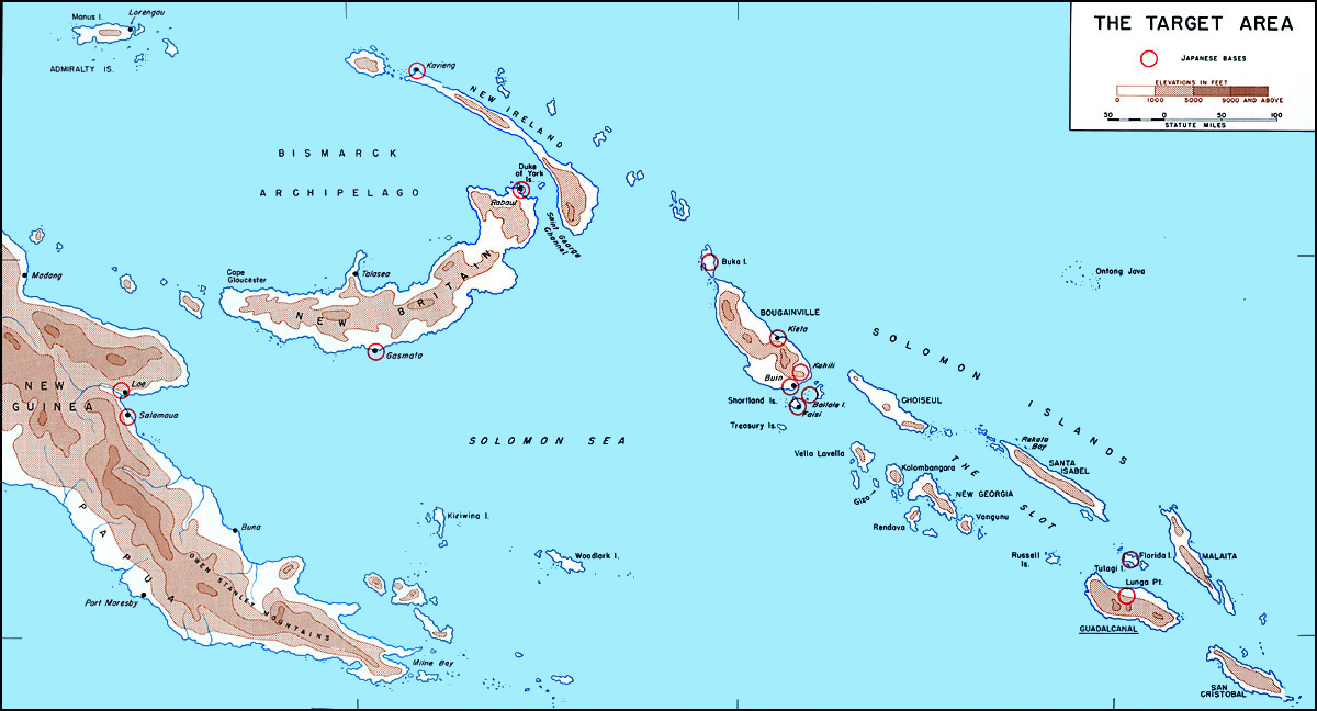

Map of Solomons area in 1942
before invasion of Guadalcanal showing Japanese bases circled in red. Image fixed by A ngelus (talk)
- Date
- 1942
- Mapmaker / publisher
- derivative version: |Permission=
- Place
- the Solomon Islands
- Archive
- Wikimedia Commons
- Type
- map
- Original size
- 1,200 × 648 pixels
Public domain
Reason: a US government work.
This status rests on the map's publication history, as researched by Wikimedia Commons. Check it before commercial use.
Read from: Commons licence category: PD US Government; no CC BY, CC BY-SA, GFDL or deletion tag on the file page; Commons tags it as a US government work, but its record names no government maker.
Credit line
"Map of Solomons area in 1942" (1942). derivative version: |Permission=, via Wikimedia Commons. Public domain. https://commons.wikimedia.org/wiki/File:Map_of_Solomons_area_in_1942.pngNeed maps for a whole project? Add Find Any Map to Claude and ask for this one by its id: 24916.
More like this

An area of Solomon Islands and Bismarck Archipelago, with places connected with WWII battles
2009 · Wikimedia Commons

UP THE SLOT: Marines in the Central Solomons
1942 · Wikimedia Commons

Map of Guadalcanal and Florida islands, December 1942 (US Marine Corps)
1942 · U.S. National Archives

Solomon Islands Campaign battles map 1944
1944 · Wikimedia Commons

The Solomon Islands - 1943
1943 · Wikimedia Commons

Lunga Point area chart prepared for landing on Guadalcanal 1942
1942 · Wikimedia Commons
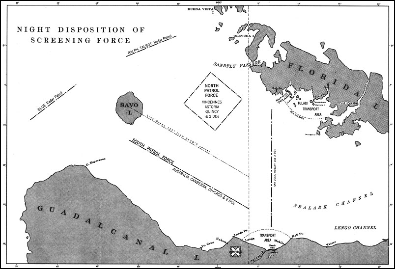
U.S. Navy map from 1943 showing disposition of Allied ships before Battle of Savo Island, 8-9 August 1942.
1943 · Wikimedia Commons

The World War II Pacific Theater as it appeared in August, 1942.
1942 · Wikimedia Commons