

Map of Silver Bow County, Montana
Relief shown by hachures. "Copyright 1890 by Gustave A. Kornberg, C. E." Related to entry # 415 in Cut and mounted on cloth.
- Date
- 1890
- Mapmaker / publisher
- Hagel, John
- Place
- Silver Bow County, Montana
- Archive
- Library of Congress (via Wikimedia Commons)
- Type
- map
- Original size
- 11,849 × 6,545 pixels
Public domainsafest
Reason: its maker died more than 100 years ago.
Read from: Commons licence category: PD-old-100-expired; no CC BY, CC BY-SA, GFDL or deletion tag on the file page.
Credit line
"Map of Silver Bow County, Montana" (1890). Hagel, John. Library of Congress, Geography and Map Division, via Wikimedia Commons. Public domain. https://commons.wikimedia.org/wiki/File:Map_of_Silver_Bow_County,_Montana_LOC_2011590008.jpgNeed maps for a whole project? Add Find Any Map to Claude and ask for this one by its id: 16439.
More like this

Topographical map of Lewis and Clarke County, Montana, 1890
1890 · Library of Congress

Sanborn Fire Insurance Map from Butte, Silver Bow County, Montana, 1890, volume 3
1890 · 31 sheets

Sanborn Fire Insurance Map from Rumsey, Deer Lodge County, Montana. sanborn05086 001
1890 · Library of Congress

Map of the territory of Montana with portions of the adjoining territories - showing the gulch or placer diggings actually worked and districts where quartz (gold & silver) lodes have been discovered
1865 · Library of Congress

Map of Elko County, Nevada - showing- surveyed land, towns, mining districts, streams, rivers, principal ranches, post offices, school districts, main reservoir sites, principal roads and railroad &
1894 · Library of Congress
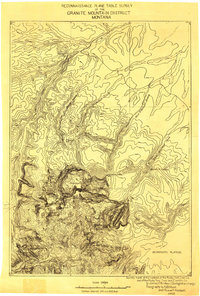
Granite Mountain District, Montana: USGS topographic map, 1:125,000 (1898)
1898 · USGS Historical Topographic Map Collection

Birds-eye view of Helena, Montana 1875.
1875 · Glover, E. S

Map of the territory of Montana with portions of the adjoining territories - showing the gulch or placer diggings actually worked and districts where quartz (gold & silver) lodges have been discovered
1865 · Library of Congress