

Map of San Fernando Valley, California
Relief shown by hachures. Shows major roads, public streets, and cities and towns in the San Fernando Valley region of the City of Los Angeles. "Copyrighted by Franklin P. Borgnis, L.A." Publication date inferred from date of acquisition. F 39086.
- Date
- 1923
- Mapmaker / publisher
- Borgnis, Franklin P
- Place
- California
- Archive
- Library of Congress (via Wikimedia Commons)
- Type
- map
- Original size
- 10,008 × 7,018 pixels
Public domainsafest
Reason: its maker died more than 80 years ago.
Read from: Commons licence category: PD-old-80-expired; no CC BY, CC BY-SA, GFDL or deletion tag on the file page.
Credit line
"Map of San Fernando Valley, California" (1923). Borgnis, Franklin P. Library of Congress, Geography and Map Division, via Wikimedia Commons. Public domain. https://commons.wikimedia.org/wiki/File:Map_of_San_Fernando_Valley,_California_LOC_2007628013.jpgNeed maps for a whole project? Add Find Any Map to Claude and ask for this one by its id: 16417.
More like this
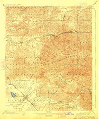
San Fernando, California: USGS topographic map, 1:62,500 (1900–1945)
1900–1945 · 5 editions

San Fernando, California: USGS topographic map, 1:24,000 (1953–1995)
1953–1995 · 7 editions
Sylmar, California: USGS topographic map, 1:24,000 (1925–1935)
1925–1935 · 6 editions

Map of Los Angeles County - electric, steam railway lines, and mountain guide and also portion of Orange County
1912 · Library of Congress

Street and section map of the Los Angeles oil fields, California
1906 · Library of Congress

Map of Orange County, California
1889 · Library of Congress

Official map of San Diego County, California - compiled from latest official maps of U.S. surveys, railroad and irrigation surveys, county records, and other reliable sources, and
1889 · Plate 1

Pictorial map of Fresno County and mid-California's Garden of the Sun.
1923 · Library of Congress