

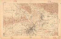
Map of Los Angeles Rail in 1906
The maps was prepared by the Travel and Hotel Bureau of Los Angeles in 1906. Includes an overlay of rail lines.:Notes; Relief shown in hachures.; Shows various city rail lines in different colors.; Stamped: ", Dec 24, 1906.":Medium; 1 map: col.; 63 x 56 cm.
- Date
- 1906
- Mapmaker / publisher
- Travel and Hotel Bureau
- Place
- Los Angeles
- Archive
- Library of Congress (via Wikimedia Commons)
- Type
- map
- Original size
- 4,000 × 4,517 pixels
Public domainsafest
Reason: its US copyright has expired (published before 1931).
Read from: Commons licence category: PD US expired; no CC BY, CC BY-SA, GFDL or deletion tag on the file page.
Credit line
"Map of Los Angeles Rail in 1906" (1906). Travel and Hotel Bureau. Library of Congress, Geography and Map Division, via Wikimedia Commons. Public domain. https://commons.wikimedia.org/wiki/File:Map_of_Los_Angeles_Rail_in_1906.jpgNeed maps for a whole project? Add Find Any Map to Claude and ask for this one by its id: 15960.
More like this

Map of the city of Los Angeles - showing railway systems
1906 · Library of Congress

Map of Los Angeles County - electric, steam railway lines, and mountain guide and also portion of Orange County
1912 · Library of Congress

Los Angeles 1909.
1909 · Library of Congress

Los Angeles, California, 1894.
1894 · Library of Congress
Los Angeles, California: USGS topographic map, 1:62,500 (1894–1900)
1894–1900 · 5 editions

Sectional & road map of Los Angeles County - including part of Orange and Ventura counties, showing the oil and mining districts
1900 · Library of Congress

Street and section map of the Los Angeles oil fields, California
1906 · Library of Congress

Map showing territory annexed to the city of Los Angeles, California
1916 · Library of Congress