

Map of Knox Co., Tennessee
Relief shown by hachures. Shows landownership. Includes statistics and directory of officials.
- Date
- 1895
- Mapmaker / publisher
- Pill, J. R.; Vance, Coffee, And Pill
- Place
- Knox County, Tennessee
- Archive
- Library of Congress (via Wikimedia Commons)
- Type
- map
- Original size
- 14,325 × 11,520 pixels
Public domainsafest
Reason: its maker died more than 100 years ago.
Read from: Commons licence category: PD-old-100-expired; no CC BY, CC BY-SA, GFDL or deletion tag on the file page.
Credit line
"Map of Knox Co., Tennessee" (1895). Pill, J. R.; Vance, Coffee, And Pill. Library of Congress, Geography and Map Division, via Wikimedia Commons. Public domain. https://commons.wikimedia.org/wiki/File:Map_of_Knox_Co.,_Tennessee_LOC_2004629227.jpgNeed maps for a whole project? Add Find Any Map to Claude and ask for this one by its id: 15926.
More like this

Knoxville, Tenn. county seat of Knox County 1886.
1886 · Library of Congress

Map of Montgomery County, Tennessee - from actual surveys and official records
1877 · Library of Congress

Bird's eye view of the city of Knoxville, Knox County, Tennessee 1871.
1871 · Library of Congress

Knoxville, Tennessee, USA (the purple area at the center), as it appeared on an 1895 map of Knox County. West Knoxville and North Knoxville were separate cities, though they would be annexed in 1897.
1895 · Library of Congress

Map of Shelby County, Tennessee
1888 · Library of Congress

Map of Rutherford County, Tenn. - from actual surveys
1878 · Library of Congress

Topographical map of the approaches and defences of Knoxville, E. Tennessee, shewing the positions occupied by the United States & Confederate forces during the siege
1864 · Library of Congress
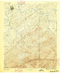
Knoxville, Tennessee: USGS topographic map, 1:125,000 (1886–1901)
1886–1901 · 10 editions