

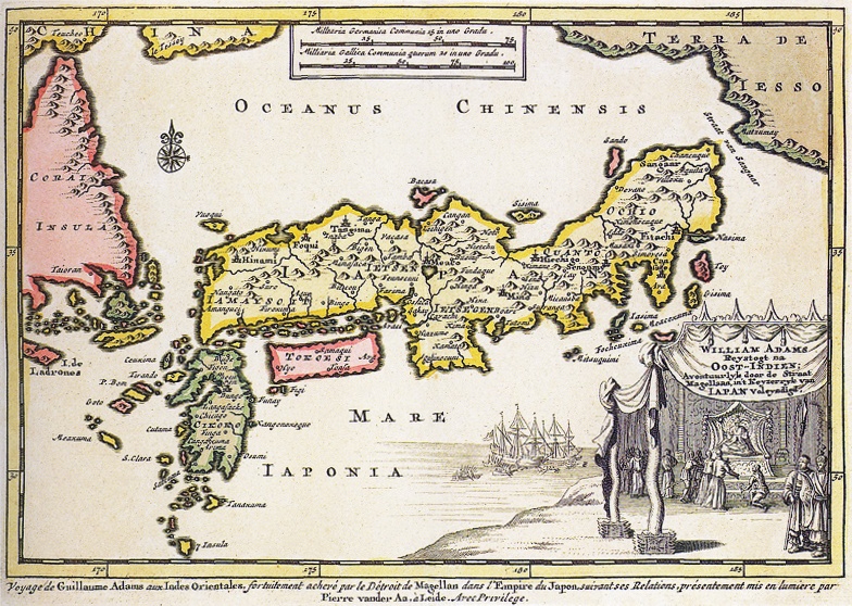
Map of Japan with William Adams who visits the Shogun in 1707. In the top right is Hokkaido (Terra de Iesso) In the top left side is a part of the Korean peninsula. The bottom right is a cartouche rep
- Date
- c. 1705
- Place
- Japan
- Archive
- Wikimedia Commons
- Type
- map
- Original size
- 3,203 × 2,197 pixels
Public domainsafest
Reason: its maker died more than 100 years ago.
Read from: Commons licence category: PD-old-100-expired; no CC BY, CC BY-SA, GFDL or deletion tag on the file page.
Credit line
"Map of Japan with William Adams who visits the Shogun in 1707. In the top right is Hokkaido (Terra de Iesso) In the top left side is a part of the Korean peninsula. The bottom right is a cartouche rep" (c. 1705). Wikimedia Commons. Public domain. https://commons.wikimedia.org/wiki/File:Map-of-Japan-1707-William-Adams-Visits-Shogun.pngNeed maps for a whole project? Add Find Any Map to Claude and ask for this one by its id: 240918.
More like this
William Adams 1707 map of Japan
1707 · Wikimedia Commons

Map of Japan
c. 1718 · Wikimedia Commons

Map of Japan
c. 1705 · Wikimedia Commons

A New and Accurate Description of Japan, the Land of Eso (Hokkaido), and Adjacent Islands from the Newest Discovery for Sale with Legal Permission at the Shop of Pieter Schenk and Gerard Valk in Amsterdam. A 455×552 mm copper-engraved map incorporating accounts (and gross misinformation) from the Du
1652 · Wikimedia Commons

Japan1744
1744 · Wikimedia Commons

Map of Japan, 1718
1718 · Wikimedia Commons

Iaponia regnum
Wikimedia Commons

Mer Orientale, où l'on trouve l'isle de Jedso, de laquelle on doutoit si c'étoit une isle ou non
1724–1729 · Wikimedia Commons