

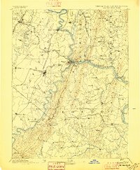
Map of Harper's Ferry
1883
- Date
- 1883
- Place
- Harpers Ferry, West Virginia
- Archive
- Wikimedia Commons
- Type
- map
- Original size
- 1,323 × 907 pixels
Public domainsafest
Reason: its maker died more than 70 years ago.
Read from: Commons licence category: PD-old-70-expired; no CC BY, CC BY-SA, GFDL or deletion tag on the file page.
Credit line
"Map of Harper's Ferry" (1883). Wikimedia Commons. Public domain. https://commons.wikimedia.org/wiki/File:Map_of_Harper%27s_Ferry.jpgNeed maps for a whole project? Add Find Any Map to Claude and ask for this one by its id: 614.
More like this

Harpers Ferry and surroundings
1889 · Wikimedia Commons

Military map showing the topographical features of the country adjacent to Harper's Ferry, Va.; including Maryland, Loudoun, and Bolivar Heights, and portions of South and Short Mountains, with the
1863 · Library of Congress

Attack on Harper's Ferry
1862 · Library of Congress

Harper's Ferry (1863)
1867 · Library of Congress

Railroad map of Harpers Ferry in 1859
1859 · Wikimedia Commons

(Military map showing the topographical features of the country adjacent to Harper's Ferry, Va.; including Maryland, Loudoun, and Bolivar Heights, and portions of South and Short Mountains, with the
1863 · Library of Congress
Harpers Ferry, Virginia: USGS topographic map, 1:125,000 (1884–1893)
1884–1893 · 9 editions

Harpers Ferry National Historical Park, West Virginia
1982 · Library of Congress