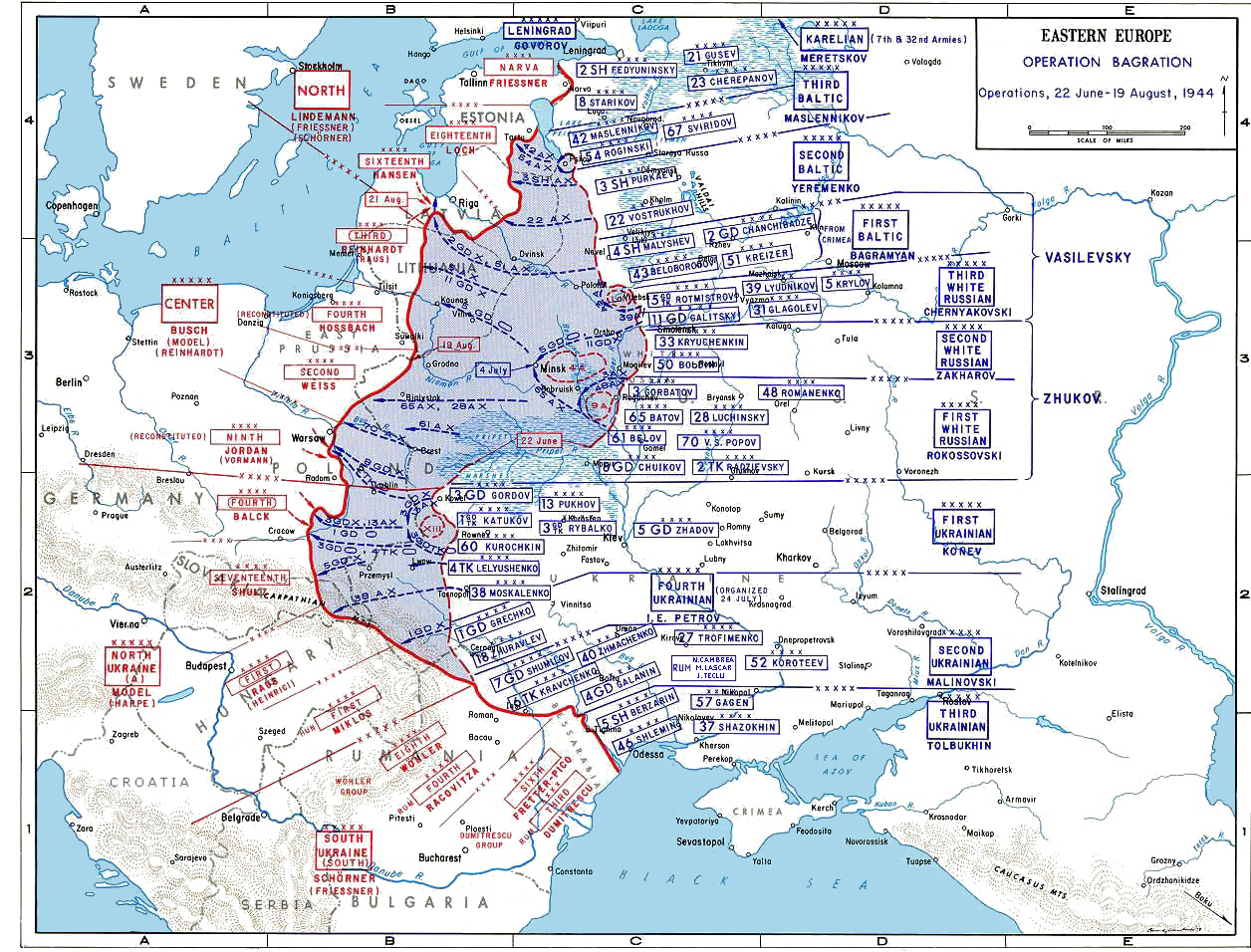

Map of deployments during Operation Bagration, June–August 1944
- Date
- 1944
- Mapmaker / publisher
- United States Army
- Place
- Operation Bagration
- Archive
- Wikimedia Commons
- Type
- map
- Original size
- 1,256 × 956 pixels
Public domainsafest
Reason: a US government work.
Read from: Commons licence category: PD US Government; no CC BY, CC BY-SA, GFDL or deletion tag on the file page.
Credit line
"Map of deployments during Operation Bagration, June–August 1944" (1944). United States Army, via Wikimedia Commons. Public domain. https://commons.wikimedia.org/wiki/File:BagrationMap2.jpgNeed maps for a whole project? Add Find Any Map to Claude and ask for this one by its id: 23581.
More like this

Белорусская операция 1944 год
1944 · Wikimedia Commons

RedArmy19Aug31Dec44
Wikimedia Commons

April1944
Wikimedia Commons

Axis Invasion of the Soviet Union, 22 June to 25 August 1941.
1941 · Wikimedia Commons

The Battle of Bialystok (in Russian and German)
1941 · Wikimedia Commons

Soviet map of Leningrad-Novgorod Strategic Offensive
1944 · Wikimedia Commons

OEF-map-6
1944 · Wikimedia Commons

East Prussia, August 17 – 23, 1914
2003 · Wikimedia Commons