

Map of Bulgaria (10th cent)
Map of Bulgaria in the 10th century
- Date
- 1896
- Place
- Bulgaria in the 10th century
- Archive
- Wikimedia Commons
- Type
- map
- Original size
- 2,333 × 1,544 pixels
Public domainsafest
Reason: its maker died more than 70 years ago.
Read from: Commons licence category: PD-old-70-expired; no CC BY, CC BY-SA, GFDL or deletion tag on the file page.
Credit line
"Map of Bulgaria (10th cent)" (1896). Wikimedia Commons. Public domain. https://commons.wikimedia.org/wiki/File:Map_of_Bulgaria_(10th_cent).jpgNeed maps for a whole project? Add Find Any Map to Claude and ask for this one by its id: 246242.
More like this

South-eastern Europe c. 910
Wikimedia Commons

South-eastern Europe c. 1000
Wikimedia Commons

Historical atlas of modern Europe: from the decline of the Roman Empire: comprising also maps of parts of Asia, Africa, and the New World connected with Europaean history
Wikimedia Commons

Samuels Macedonian Kingdom
1886 · Wikimedia Commons

Brockhaus and Efron Encyclopedic Dictionary b59 288-3
1890–1907 · Wikimedia Commons

C. 950 Eastern Roman Empire in Europe
1888–1897 · Wikimedia Commons

Europe 912
1905 · Wikimedia Commons
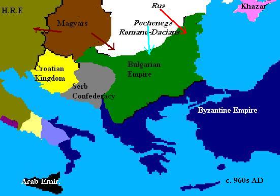
Balkans 960s
September 29, 2007 · Wikimedia Commons