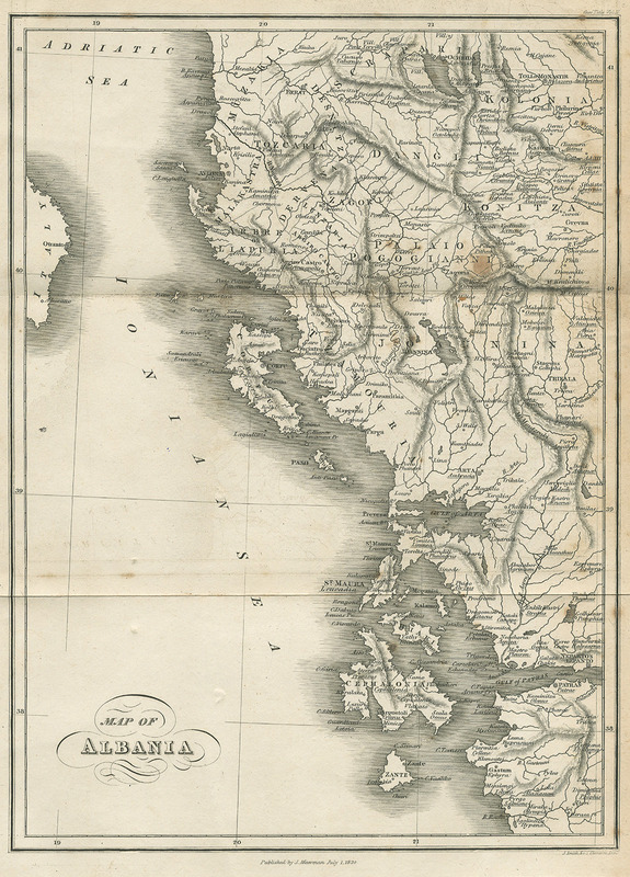

Map of Albania - Hughes Thomas Smart - 1820
Thomas Smart Hughes, Travels in Sicily Greece and Albania… Illustrated with engravings of maps scenery plans, vol. I, London, J. Mawman, 1820.
- Date
- 1820
- Place
- Albania
- Archive
- Wikimedia Commons
- Type
- map
- Original size
- 575 × 800 pixels
Public domainsafest
Reason: public domain: Art (PD-old).
Read from: Commons licence category: PD-Art (PD-old); no CC BY, CC BY-SA, GFDL or deletion tag on the file page.
Credit line
"Map of Albania - Hughes Thomas Smart - 1820" (1820). Wikimedia Commons. Public domain. https://commons.wikimedia.org/wiki/File:Map_of_Albania_-_Hughes_Thomas_Smart_-_1820.jpgNeed maps for a whole project? Add Find Any Map to Claude and ask for this one by its id: 251455.
More like this

Map of Albania - Hobhouse John Cam Lord Broughton - 1813
1813 · Wikimedia Commons

Map of Albania in 1791 by Reilly 022
1791 · Wikimedia Commons

1816 Carte de la Turquie d'Europe - Sheet 2
1816 · Wikimedia Commons

Carta d'Albanie - Beauvau Henri De - 1615
1615 · Wikimedia Commons

Map of the Morea, Albania, and other parts, illustrative of De. Pouquevilles travels
1813 · Wikimedia Commons

Novantiqua Epirus quae hodie Albania: Epirus Pyrrhi patria / I. Laurenbergio
1721–1778 · Wikimedia Commons

Epirus, hodie vulgò Albania / autore I. Laurenbergio
1650 · Wikimedia Commons

Epirus, hodie vulgò Albania
1650 · Wikimedia Commons