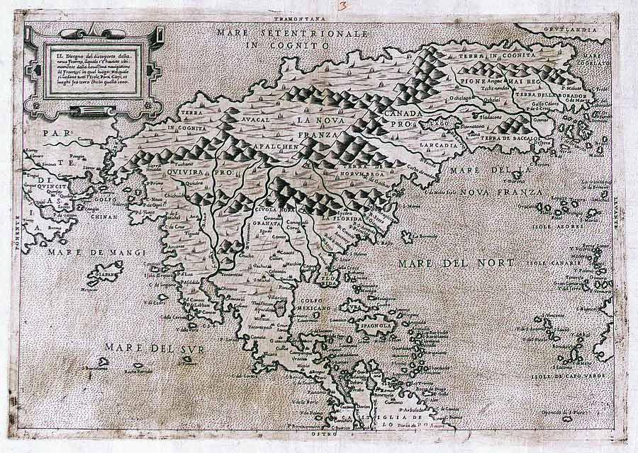

Map North America 1566
- Date
- 1566
- Archive
- Wikimedia Commons
- Type
- map
- Original size
- 900 × 640 pixels
Public domain
Reason: its maker died long enough ago that the copyright has expired.
This status rests on the map's publication history, as researched by Wikimedia Commons. Check it before commercial use.
Read from: Commons licence category: PD Old; no CC BY, CC BY-SA, GFDL or deletion tag on the file page.
Credit line
"Map North America 1566" (1566). Wikimedia Commons. Public domain. https://commons.wikimedia.org/wiki/File:Map_North_America_1566.jpgNeed maps for a whole project? Add Find Any Map to Claude and ask for this one by its id: 294727.
More like this

Il disegno del discoperto della nova Franza.
1566 · Wikimedia Commons

Il Disegno del discoperto della Nova Frantza, ilquale s'é havuto ultimamente dalla novissima navigations de Franzesi in quel luogo nel quale si vedono tutti l'Isole, Porti, Capi et luoghi fra terra che in quella sono
1566 · Wikimedia Commons

Atlas type Lafréri
1543–1577 · North America, plate 214 of 226

North America, east coast
1547 · Wikimedia Commons

Gastaldi Map
1556 · Wikimedia Commons

Atlas de Lyon / anonyme
1580 · North America, plate 36 of 66

Karte der Ostküste Nordamerikas
c. 1538 · 4 sheets

Map of eastern Canada.
1565 · Library of Congress