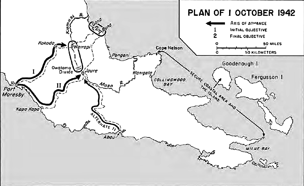

Map Milne Bay to Oro Bay-Gona-Buna
Map 6, Plan of 1 October 1942 showing supply lines Milne Bay to Oro Bay-Gona-Buna operations area.
- Date
- 1957
- Mapmaker / publisher
- U.S Army
- Archive
- Wikimedia Commons
- Type
- map
- Original size
- 1,019 × 624 pixels
Public domainsafest
Reason: a US government work (US Army).
Read from: Commons licence category: PD US Army USACMH; no CC BY, CC BY-SA, GFDL or deletion tag on the file page.
Credit line
"Map Milne Bay to Oro Bay-Gona-Buna" (1957). U.S Army, via Wikimedia Commons. Public domain. https://commons.wikimedia.org/wiki/File:Map_Milne_Bay_to_Oro_Bay-Gona-Buna.pngNeed maps for a whole project? Add Find Any Map to Claude and ask for this one by its id: 24607.
More like this

Axes of Advance, Papuan Campaign
1966 · Wikimedia Commons

USA-P-Papua-13 Map 13 milner 18-28 December 1942
1957 · Wikimedia Commons

USA-P-Papua-14 Map 14 milner18-28 December 1942
1957 · Wikimedia Commons

The Envelopment of the Huon Peninsula 1943-44
1966 · Wikimedia Commons

USA-P-Papua-10 Map 10 milner Situation on Approaches to Buna Evening, 30 November 1942
1957 · Wikimedia Commons

USA-P-Papua-11 Map 11 milner Sanananda Front December 1942
1957 · Wikimedia Commons

Allied Advance Across Owen Stanley Range 1942
1957 · Wikimedia Commons

USA-P-Papua-VI Map VI milner Closing in on Japanese Beachhead 16-21 November 1942
1957 · Wikimedia Commons