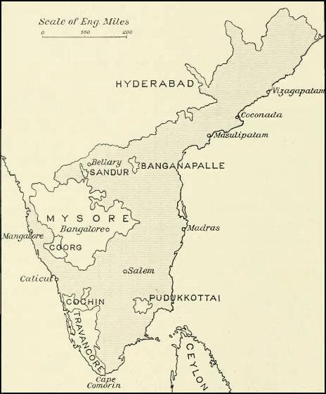

Madras map 1913
Madras Presidency, Coorg and associated states
- Date
- 1913
- Mapmaker / publisher
- Edgar Thurston
- Place
- South India
- Archive
- Wikimedia Commons
- Type
- map
- Original size
- 464 × 560 pixels
Public domainsafest
Reason: its maker died more than 80 years ago.
Read from: Commons licence category: PD-old-80-expired; no CC BY, CC BY-SA, GFDL or deletion tag on the file page.
Credit line
"Madras map 1913" (1913). Edgar Thurston, via Wikimedia Commons. Public domain. https://commons.wikimedia.org/wiki/File:Madras_map_1913.jpgNeed maps for a whole project? Add Find Any Map to Claude and ask for this one by its id: 255902.
More like this

S India1893
1893 · Wikimedia Commons

Map of Madras (Southern section) with Mysore, Coorg, and Travancore from The Imperial Gazetteer of India (1907-1909)
1907–1909 · Wikimedia Commons

Madras Prov South 1909
1909 · Wikimedia Commons

Map of "Madras Presidency" from. Scanned from personal copy and uploaded by Fowler&fowler «Talk» 20:58, 6 March 2009 (UTC)
1880 · Wikimedia Commons

Madras Prov South 1909 Mysore
1909 · Wikimedia Commons

Madras Prov North 1909
1909 · Wikimedia Commons

"Map of the Presidency of Madras," 1880
1880 · Wikimedia Commons

EB1911India - map (southern part)
1911 · Wikimedia Commons